Wishful Thinking!

I’ve been home now for four straight days and I’m already thinking about going back to New Zealand.  Sort of.  I always said I would return for a second trip, but when I was checking my points, I noticed that I had enough points to get me a flight to Auckland.  And then it was like, Holy Crap!  This could happen a lot sooner than I thought.  Perhaps not tomorrow, but rather than five years later, it’s more like two maybe three years later.  Of course it could just be that I’m missing Middle-Earth very much and I’m still longing for a volcano.  Or it could be the jet lag that’s muddling my brain waves.  Granted it’s not much of a time difference.  When it’s quitting time for me, it’s actually noon in Wellington.  But when it’s time to wake up in the morning to get ready for work, it’s 3am in Wellington.  So by the time it’s quitting time, I’ve been wanting to nap for probably 2 hours already.  It could be that I’m reminiscing with my friends and telling them how fantastic the trip was and answering all their questions such as what was my absolute most favourite thing that I did – Kayaking in Doubtful Sound, to what would I not do or avoid the next time I go to New Zealand – nothing really bad happened on this trip but I there are some places where I can say that I’ve been there, done that, don’t need to do it again such as The Forgotten World Highway and the Surf Highway.  There are more things that I would like to do again than there are things that I wouldn’t do.

Doubtful Sound Kayaking trip for sure.  Perhaps Milford Sound again.  It would be nice to see it when the weather is nice.  Seeing as Mitre Peak was completely cloud covered when I went back in January.  But I did see some amazing temporary waterfalls.  I might consider doing the complete Milford Track.  I would return to Queenstown and Glenorchy and Paradise and perhaps walk a little bit more of the Routeburn track.  Not the full track, but a little more of the Routeburn.  I think I’m okay with skipping the Southern Coast such as the Catlins and Dunedin.  I would definitely return to Arrowtown since it’s so close to Queenstown.  I would spend more time in Wanaka.  And instead of the two nights in Franz Josef, I would do three nights in Franz Josef.  I’m okay with skipping Pancake Rocks but I would definitely return to Arthur’s Pass and spend two, maybe three nights there.  Probably two.  I will skip Christchurch this time and head right back to my little piece of heaven on Lake Pukaki.  I would spend four nights there.  This second time, I would drive up to Nelson and the Abel Tasman area to get in some good kayaking before heading to the North Island.  Wellington would be a must, for sure.  At least 4 nights to fit in Cape Palliser and the Pinnacles.  I would have to time it right so I could get in the AMI Round the Bays again.  And then I’d be on my way back to Tongariro National Park, for the Alpine Crossing and climbing Mt. Doom.  I foresee another 4 nights there.  Then it would be off to Rotorua and perhaps another visit to Hobbiton, maybe.  But second time around, I might just start in the North Island and work my way down to the South Island and then from Queenstown, head home.  I would definitely return in February, perhaps after Chinese New Year and depending on what I want to do, I would certainly consider another two month stint, at least 6 weeks.  But who knows?  It’s all just wishful thinking right now.  There are some many things that could happen in two or three years.  But wishes are just goals that haven’t been fully thought out just yet.

In the meantime, I have to get on with my life in Vancouver.  It’s kind of weird.  I hopped into the car and I had to think about how to drive.  I actually turned the windshield wipers on a few times when the intention was to turn the blinkers on.  Everything in my car seems to be on the wrong side.  It actually feels like I’m driving on the wrong side of the road as well.  Oh dear.  I returned to work and discovered I have a new boss.  That’s cool.  It’s only been two days, but I’m still in vacation euphoria.  I plan on making this euphoria last, if not forever, then at least another 50+ days, until the Sun Run and then the running can replenish the euphoria.  I returned to my kickboxing class last night and was beaten to a pulp.  I’ve got a really ugly bruise on my hand and on my shins.  The last time I had such an ugly bruise was when I sprained it during the Tongariro Alpine Crossing.  And no, it’s not a sprain.  Though it does look kind of swollen.  But it’s a part of the hand that can’t be sprained (this thought coming from me, with zero medical background).  My shins aren’t that much better either.  I forgot how to kick properly.  Ai Yah.  But at least my cardio is still good.  I know it’s only been four days but I’m already setting new goals.  I plan on registering for the Vancouver Sun Run.  Whether I run or walk it, will depend on if Sister C joins me and also if my little niece will come along as well.  I am already looking at other races as well.  There is a half marathon on June 22 but there is also a 5 km run at at the same time.  Then there is a 10 km run in September and then another 10 km run in October as well.  Tomorrow I’ll be headed back to my spinning class.  Normally on thursdays I would go to a Cardio Kickboxing class, but Sister C said that Josh was no longer teaching the class.  And not that I need to have Josh teach the class, but the other instructor tends to focus more on kickboxing technique and I don’t want to get my Muay Thai Kickboxing technique confused with the Cardio Kickboxing class.  So I have to stick with Faraaz.  On the monday, I did try out a new exercise class called BellyFit:  Warrior.  It’s not my kind of class.  I will stick with spinning on Mondays.  It’ll soon be time for me to hunt out places to go hiking as well.  There is still snow on the mountains, so it certainly won’t be higher elevation hikes.  But vancouvertrails.com has some hikes listed as year-round.  And I might look into joining a hiking club.  I’ll have to see.   I need to get settled back into home first and get used to the cold again.  I think I might actually be coming down with a cold or maybe it’s just my body getting back into the routine of my hands and feet being freezing, again.  Grrrr!  and Brrrr!  So far I’ve been lucky not to encounter snow.  I know it snowed the week before I returned home.  And It’s not like I’ve never seen snow before.  It snowed before I left Vancouver two months ago.  But seeing snow, after being in summer, even a southern hemisphere summer, would just be the like a fly in my L&P.  Bleh!

Hopefully after this weekend things will feel more normal.  Though it doesn’t help that it’s daylight savings time this weekend.  So on Monday when I’m up at 6am, it’ll be like waking up at 2am in Wellington.  Think Positive!  Home Sweet Home?  Yes.  It was good to see the kids again.  Wow have they ever grown!  Little Brother Z talks so much more now.  And Big Sister Z is more independent.  And I’ll get to see Big Sister B and Little Brother N this weekend as well.   Actually I’ll get to see all the kids this weekend.  So yes.  Home Sweet Home!  It’s good to be back.

My Dearest…

My Dearest Dears,

If I have scheduled this properly, this post should be up by the time I am more than half way back home.

My Dearest Friends,

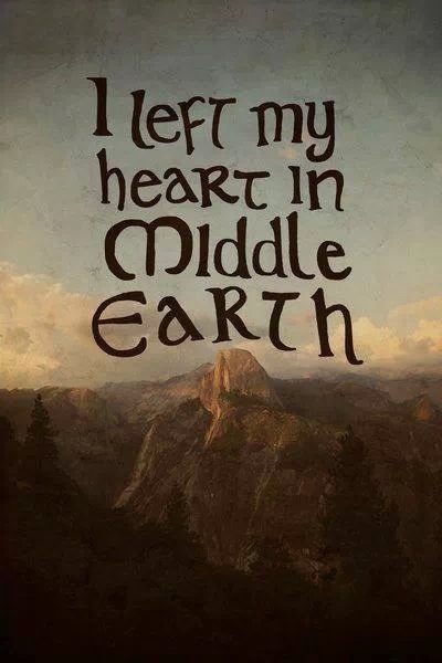
My time here in Middle-Earth has come to an end.  I am very sad to be leaving this place, but I know I will be back.  I can promise you that.  I can’t say I’ll be back soon, but I’ll be back.  As this photo from Facebook says, I left my heart in Middle-Earth.  Yes and no.  My heart is big enough to encompass Middle-Earth.  I will bring it home with me.  And no, I am not talking about all the souvenirs, but the wonderful memories and experiences from these last two months.  Middle-Earth, no, New Zealand will live in my heart no matter where I am on this earth.  The people I have met, the friends I have made will be with me even though we are on the other side of the world from each other.  Take care of yourselves.  I expect to see you when I return.  Thank you for making this trip such a memorable one.  Some of you might think that you only had a small part in my experiences, but even the smallest parts added up together makes a great experience.  Thank you.  I have loved every moment here in New Zealand.

20140302-110701.jpg

My Dearest Nieces and Nephews, My Dearest Darlings,

I have had the greatest adventure these last two months and I can’t wait to share it with you.  First off, I have to say that I have missed you all greatly.  Even though I chose to go on this adventure, I still missed playing with you and seeing you whenever I could.  And I thought of you quite often, usually when my adventures were so breathtaking and I wished I could’ve shared it with you.  Perhaps one day, when I return for a second adventure, you’ll be able to come with me and share in this magical experience.

When I get home, I want lots of kisses and hugs please!  I hope you missed me too.  I will have lots of pictures to show you and lots of stories to tell you.

I will tell you about all the new friends that I met on this trip that made the experiences even better than I had hoped.  I will tell you about travelling light and how impossible that is if you are gone for two months.  I will tell you about all the sheep and cows that cover this land.  I can’t wait to tell you all about the stars in heaven and the beautiful sound of silence and the excitement of kayaking in stormy weather.  Wait till I tell you that I drove on the wrong side of the road for two whole months!

I hope you will like the presents I brought for you.  They were all a little something of this wonderful country that I disappeared to.  And I think you are old enough for me to read you a story about a hobbit who lived in a hole in the ground.

Would you like to come out with Aunty when she goes to exercise?  What about a little walk around the park?  Or a run?  It’s never to early to start running.  Or maybe I should wait till your a little more coordinated on your feet perhaps?  Would you like to do the Sun Run with me in April?  I would like a little company.  If it’s still snowing, we can go out and make a snowman, or how about snow angels?

After two months on my own, I would like company.  I was never lonely these last two months, even though I was alone.  I always met nice people who were chatty and curious.  But they were not company.  They did not lay under the stars with me and whisper ‘Oh Wow’ with me when the shooting stars zoomed by.  They did not break the glassy surface of the waters in Doubtful Sound in a kayak nor did they hear the Kiwi bird in the Kauri forest in the Northland.  People were there, but they were not company.

I will tell you about a good friend I met in this lovely city called Wellington and I am so thankful for it because she helped me to enjoy the city even more.  I made another friend in this beautiful place called Paradise, who also helped me learn new things with my camera.  Can I take your picture when I get home?  I promise not to use the flash and maybe I can teach you how to take good pictures of your own!  I have learned a lot from these new friends.

And that’s one of the most important things about going on an adventure.  You should always return home with a little more knowledge than before you left home.  It doesn’t matter what you learned as long as you learned something.

My Dearest Nieces and Nephews, My Dearest Children,

I can’t wait to share in your adventures as you grow up to be smart and beautiful adults.  I hope that along the way I can add a little to your knowledge of life, because fair’s fair.  You have already added to my life just by being in it. I thought my heart could not get any bigger when I held you in my arms and introduced myself to you. But then I went away and discovered a new country, a new Middle-Earth and my heart just grew bigger. And now I can’t wait to share because keeping it all to myself will only make my heart burst.

A wise old wizard once told a little hobbit that there was no guarantee of returning from an adventure and even if he did return, he would not be the same.  I am returning now from my adventure, my dearest little ones.  But I am not the same Aunty that left Vancouver all those two months ago and I hope that you’ll think that I am better for it.

Be good for your moms and dads.  I’ll be home soon and then we can play.  Luv, Aunty!

Awkward Auckland! Awesome Eden!

March 1 and 2, 2014

So, of all days to be five minutes late, it had to be the day I fly out to Auckland.  I checked in just fine the night before but I was five minutes late checking in my bags at the airport.  GRRRR.  I could not get onto the flight now.  That would normally have me slightly more than freaked out, but since the day was still early, 7:30am, I figured I’d be able to catch a later flight.  When I booked this flight, I bought the flex fare, just incase.  Thank goodness I did.  Because almost all the flights were booked for Auckland on this first day of March.  Who knew that Bruce Springsteen was in Auckland for the weekend?  And Who knew that there were so many Bruce Springsteen fans in Wellington?  Certainly not me!  So when the Air New Zealand duty supervisor was checking the flights for me, the only flight that had any promise was the 7:30pm flight.  Hmmm.  Well, that would mean another day in Wellington.  That’s alright.  But the supervisor did try to get me onto the next flight, which was very nice of him.  However I ended up getting bumped off, because everyone that had booked the 8:30 flight had arrived for that flight.  So when they paged me, I kind of figured I wasn’t going to be on the 8:30 flight.  But then he told me that my bags were still on the flight and headed to Auckland without me, and all I could think of was, Hmmm.  I think I forgot to lock one of those bags.  Well, if they want to steal my dirty laundry, they can have it.  It’ll lighten the load for me.  I was unfazed.  Unfortunately for the supervisor, he was telling me that his supervisor wasn’t too happy with him for putting me on a full flight.  I hope he doesn’t get into too much trouble.  He was just trying to be helpful.  So the next step, he put me on standby for the 9:30 flight.  He said there was a slim chance I’d make that flight but there were 8 people that had yet to check in.  He said to check back in 30 minutes with him.  Because the flight was delayed, these people who had yet to check-in would not know so there was some slim hope yet.  Well at 9:20, when we were supposed to be boarding, the plane had not yet arrived and then the arrivals board indicated that the flight would not arrive until 10:35.  Hmmm, well. It’s a good thing I did not make any plans in Auckland.  Again, unfazed.  But now I had time to get a coffee and a small breakfast.

I plunked myself down just below Gollum and while he was going after fish, I had a ham and cheese croissant with a flat white.IMG_2653I worked on the blog for a bit and then wandered the rest of the airport.  If you remember the last time I was at the Wellington airport, there was the amazing Gollum and fish figures attached way above us as well as the eagles, one with Gandalf and one by itself.  If you also remember, during the Wellington earthquake, one of the eagles fell down, not the one with Gandalf.  Sadly, this eagle is now missing.  It was not restored to his original position.  Maybe they had to check it out make sure it was still sky worthy?  I don’t know.  But it wasn’t there.  It was still amazing to see Gandalf on his eagle and to see Gollum going after the fish, but it’s an empty void without the other eagle.  While I wandered, I also saw this lovely message just on the outside of the airport building.  I am leaving the Middle of Middle-Earth.  That is such a sad thought.

So after arriving at the airport just before 7:30, I was finally on the plane at 10:30.  And then we were delayed on the plane.  And coincidentally, it was because someone couldn’t make the flight and they had to offload their luggage.  Finally at 10:45, we were up in the air.  We arrived in Auckland just after 11:30 and then we were delayed.  We were now waiting for the tunnel to attach itself to the door so we could get out.  Once the doors were open, we were finally on our way.  And only in New Zealand can one be happy to be in a tunnel (I know it’s the wrong word, but I can’t remember what it’s called right now).  As I walked through this tunnel, looking left and right, I was looking into the rooms of Bag-End.  It was really neat!  and just brought out a big smile.  It was like being a guest in Bilbo’s Hobbit hole.  Tee Hee!  Good thing I wiped my shoes clean before stepping into the plane!  I probably would’ve irritated a lot of people if I stopped and started taking photos.  There were a lot of people who had to catch connecting, international flights on this particular flight.

Once I finished admiring the walls of the tunnel, I was reunited with my bags.  It seems that my bags were going around and around for about an hour on the belt.  And I still have my dirty laundry.  I guess there’s no appeal there.  Not a problem, at least not for me.  My next step was to head over to the International Terminal.  I now had two check-in bags, a back-pack carry-on and a large handbag.  I did not need to lug around with me all this stuff.  I had to get rid of one check-in.  So over at the International Terminal, I stood in the line-up for baggage storage.  Again, who knew that so many people would want to store their luggage, or get there luggage all plastic wrapped.  Once this step was done, it was time to get to my hostel.  Yes, I am back to hostels, mainly because Auckland Hotels are so ridiculously expensive, kind of like Vancouver ridiculously expensive.  I really miss small towns.  Anyway I found the shuttle, and headed into town.  And I could not check in ‘till 2pm.  Good lordy!  That was a whole hour away.  So as I write this, I am plunked down in their lounge waiting for time to tick away and as I try to focus, I can hear people talking about the Bruce Springsteen concert and how lucky they are to go and see him.  Good for them.

As soon as I get my room I’m off to Queen street.  I’m not sure what is there, but it’s like one of the main streets in Auckland.  So there has to be shops and restaurants and lets hope the shops are open a little later than 5pm.  But then again it is the weekend.

I wonder what Sunday will be like in Auckland?

Quiet!  That’s what Auckland is like on a Sunday.  A lot of places were closed on a Sunday.  I don’t think I’ll ever get over that.  Even in a big city, places are closed on a Sunday.  Of well.  I figured as much.  Which is why I went in search of Mt. Eden.  You can’t close a park, or in this case a reserve.  The Tahaki Reserve.  Before leaving Vancouver, Marc had told me about Mt. Eden and how he had taken lovely photo of is wife there so I thought I’d check it out.  It was that or head to Albert Park where the Auckland Art Gallery was located.  Since it was kind of a cloudy day, the Art Gallery probably would’ve been a good choice, but with the cloud cover, it would make for a nice hike to Mt. Eden, though the view may have been questionable.  I chose Mt. Eden.  And I’m glad I did.

The walk to Mt. Eden was nice, until Google Maps sent me to Mt. Eden Correctional facility rather than Mt. Eden the extinct volcano.  Perhaps I should’ve been more specific in my destination.  But as I approached the correction facility, which looks like it’s an old castle, I could see just behind it, Mt. Eden.  I wasn’t that far from the extinct volcano.  So shutting off the app, I just walked towards the mountain, making sure it was always within sight.  But prior to arriving at my surprise jail, as I walked along Karangahape Road, I came upon something rather unexpected.  The Symonds Street Cemetery.  It was unexpected because its in the middle of the city, and now that I think about it, the correctional facility is also in the middle of the city.  But the cemetery was old.  There were tombstones that date back to the 1800s.  And it was sad as well.  Because it didn’t look like anyone actually visited this place.  There were some tombstones that had overgrown bushes covering them up but there were some that looked to be well taken care of.  It was actually a very interesting and almost pleasant, peaceful location, the only location with tree cover.

After wandering through the cemetery, I continued my way across the Symonds Street bridge and following the directions, made it to the jail.DSC_7973 DSC_7975So, like I said, I shut off the app and followed my eyes to Mt. Eden.  It’s just under 200 metres high, so not really much of a hike, but once at the top, the views of the city were quite impressive.  The view of the old crater was also impressive.  You’re not allowed into the crater because it’s sacred, but just standing around the rim and looking down or across to see the view of the Auckland Sky Tower was pretty impressive.  How lucky these people are to be able to climb a volcano that is 30 minutes walking distance from the CBD.  I say lucky because I assume it’s extinct, with all the grass growing in the crater.  As long as there are no more volcanoes that pop up, I will always think they are lucky, except for the earthquakes.

Afterwards it was time to head back to the hostel and get cleaned up.  The shuttle would be picking me up at 4 to get me to the airport by 5pm.  My flight is at 8pm and if all goes well, I should be back home by 12:30pm.  I am so close to home now.  I am going to be so sad to be leaving New Zealand.

I just had to share this last photo, if you haven’t seen it on my Facebook page.  I am at the airport now.  Three hours ahead as per standards.  And as per instructions, I am now relaxing.  I love New Zealand!

photo

Almost home now, Luv, Aunty!

No more driving! I will walk Wellington!

February 27 and 28, 2014

There’s not much to say about the 27th.  I was in Masterton overnight, on my way back to Wellington.

Wind farm just outside of Masterton.

Wind farm just outside of Masterton.

I had originally planned on heading out to Castle Point and then down to Cape Palliser but my car Rental Agreement was for me to hand in the car at 430pm that day, so that actually didn’t give me much time to see and enjoy the sights.  So I had to pick.  Castle Point or Cape Palliser.  I couldn’t pick.  So I headed out to Castle Point, or at least 1/4 of the way before doubts popped up, and the state of the road (narrow and unmarked, but sealed) and I turned around and headed towards Cape Palliser.  I was making good time too.  Masterton is not that far from Wellington, about an hour and half, two hours if you search for a place for coffee (second breakfast) or if your GPS goes insane again.  I will be so happy to get rid of the GPS.  Loved the car.  Makes me think about getting a Toyota when my own little car gives up on me.  So off to Cape Palliser, until my GPS made an interesting bling and then a screen popped up.  There was a traffic incident on SH1.  Hmmm.  That is interesting.  I’ve never had any GPS do that before.  So I actually pulled over and read the message.  It didn’t really say anything except that traffic was almost at a stand still.  So I pressed the button that said avoid.  But I had a funny feeling that Cape Palliser was no longer on the schedule.  So I changed my final destination.  I would head straight for Wellington and just enjoy the city some more.  Cape Palliser would be on my list for my next visit.  And trust me, I will be back.

Upon arrival into the city, I returned to Weta Cave, yes, again.  But hey, once a LOTR/Hobbit fan, always a LOTR/Hobbit fan.  You never know if something new has popped up, since being away for two days.  Nothing new popped up.  But it was still nice to admire the statues from all the different scenes from the movie.  Again I returned to the Roxy Theatre to their cafe.  While there, I discovered some photos on the wall that I had never seen before.  Photos of the Hobbit actors, probably attending a showing of the Hobbit.  This one is my favourite photo.

William Kircher and Richard Armitage

William Kircher and Richard Armitage

I could’ve ordered several more chai lattes just to look at this picture, but it was time to go.  I headed back into the city to check in.  GPS, I shall hold my tongue this one last time.  I am so close to getting rid of you.  I just need you to get me to my hotel.  Yes, that’s right.  Hotel.  I plan on living it up this time for my final two days in the capital city.  I am staying at the Bolton Hotel to end my holiday.  Technically it’s not the end, I still have to get to Auckland, but this is Wellington.  Leaving Wellington might as well signal the end of my holiday.  After almost six weeks of hostels, The Bolton was posh.  It was in a pretty good location, about 5 minutes from the Railway Station, which is pretty good considering that the Downtown Backpackers Hostel that I stayed in last time I was here was just across the street from the Railway station.

Finally, after check-in, I could get rid of the car.  Until the guy at the Apex said I was dropping it off one day early.  WHAAAA?  Then I remembered that I had booked an extra day back in Vancouver thinking I might need it.  Well, by this time I was so ready to get rid of the car and the GPS that I didn’t care.  I told him that I was done with the car, more specifically the GPS.  The car was great.  But since I was now back in the city, I had no intentions of leaving the city again in the next 24 hours and I was perfectly happy walking around rather than driving.  So I handed him the key a day early.  And then hopped right back into the car but this time into the passenger seat so that they could drive me back to the hotel.

Hurray!  I was back to relying on my own two feet and my own internal GPS, and the Google Maps App on my iPhone.

The first stop after settling in?  Lambton Quay, on my way towards Cuba Street and then Courtenay Place for dinner at Strawberry Fare.  Now Lambton Quay is not actually a place, but a street.  But there are lots of shops and arcades on this street.  It is a shoppers heaven.  I wasn’t really out to shop, but just browse.  After repacking my bags several times, I have come to the conclusion that I cannot buy anything more.  I have reached my weight limit and really, there is nothing left to buy.  I have gotten everything I need for family.  Z and Z, B and N, you kids are covered.  Sisters, you are covered.  Mom is covered.  Brother-in-laws, you’ll have to live vicariously through the Sisters, unless you want key-chains.  It was now just all about strolling and seeing.  In Wellington there is a lot public art as in sculptures located along the wharf and throughout the city.  As I headed walked along the streets, it was interesting to see collapsed roman columns in front of a building…interesting art.  There is the iconic piece, the silver metal ball that is strung up so that from certain angles it looks like it’s just floating above the square.  Pretty cool.IMG_2627

I believe there is actually a self-guided walk that you can do to see these sculptures.  However I got distracted by a yarn shop.  In the Grand Arcade on Willis Street, is the new Holland Road Yarn Company.  I had heard about this new location from Kiwiyarns Knits and I was very happy because that meant I wouldn’t have to drive out to Petone to their original store.  However when I got there, it was a tad bit empty.  It was a large store, perhaps too large for the amount of stuff they were carrying.  Maybe if they threw in some comfy sofas for people to lounge around with their projects, then it will feel more welcoming and less sterile.  The products that they were carrying was nice stuff.  I thought I would actually walk away with some New Zealand made wool, lace weight, however they were one one skein short of what I needed for the project that I had in mind.  Curses!  So close.  SO CLOSE!  I ended up walking away with two skeins of Made in Peru lace weight yarn, in a lovely grey/slate/ash colour.  Misty Alpaca is on the label.  I don’t know if that’s a brand or not.  It’s not made in New Zealand but it was purchased in New Zealand.  Close enough.  They also had the Stansborough wool as well, but not lace weight.  Oh well.IMG_2625

Onwards, to Cuba Street.  I’ve been here before.  Just off Cuba Street on Left Bank there is a Knit World that I had been to and gotten some cute dolly patterns.  After browsing through their patterns I headed off towards Courtenay Place and Strawberry Fare.  Last time I tried to go there with Deanna, they weren’t open till 5pm.  Which was cutting it close because we had a movie at 5:45.  So this time, I was on my own and had a their chicken and mushroom penne and the Lemon Chocolate Cheesecake.  Delicious.IMG_2606Of course I had to work off this indulgence so I walked along the wharf and browsed the open stalls.  On thursdays in the summer, until sunset, there is Salsa dancing on the wharf.  Pretty cool.

The next morning, I slept in.  It was so nice.  The only thing I had on the agenda was to finish Te Papa.  I had gone to see it on the Monday but only saw the second floor.  This time I would have the whole day to see the rest.  I didn’t think I’d actually take up the entire day to see this museum, but I was wrong.  Perhaps that explains why there are two cafes in this museum, one on the ground level and one on the 4th level.  This is a fantastic museum.  There is so much to see and do here.  And my most favourite part of the museum?  NO, not the kids store with the Hobbit stuff, but the section in the museum on imported pests!  A whole section devoted to invasive creatures brought in to the country.  It was so cool!  And it really shows how much this country values their agricultural industry!  It’s a shame some other countries and respective agencies aren’t like that.  Did I mention that they make quarantine announcements on the radio!  I was listening to their National news radio station and was pleasantly astonished when they announced that a particular insect was found in a certain region of New Zealand and all people within that area should not carry fruit to other regions!  Quarantine Radio Announcements!  Cool!  Anyway there were other fascinating displays there as well, such as the Maori sections.  If you plan on coming to see this museum, I kid you not, you will need the entire day.  Start on level 4.  I thought this level was the most interesting.  Then move down.  Level 5 and 6 were interesting, but not really my cup of tea.

Level 6 was nice because there is an outdoor observation deck that gives you a nice view out to the wharf.  While I was up there, I saw some people doing, I think, a Haka chant and then they all ran and jumped into the water.  Crazy.  It was super windy and cold up on Level 6.  I can just imagine how cold it was in the water.IMG_2629 IMG_2630After watching this, I headed back down.  I haven’t seen all of the museum, but I saw all the parts that I was interested in.  Now it was time, hey, it was time for dinner.  I truly spent the entire day inside the museum.  I could’ve eaten at the museum.  The cafe on the 4th level was pretty good for lunch, I’m sure dinner would’ve been good too.  But I wanted to see what else was out there.  After examining a good number of restaurants along the wharf, I returned to Cuba Street.  This time I was here for the night market.  It’s supposed to start at 5pm and go until dark.  Well at 6pm, there wasn’t much set up.  The food stalls were only just beginning to set themselves up for the night and there were two stalls selling knick knacks.  I don’t need knick knacks.  I was looking for food.  But I didn’t want to wait so I decided to head back the way I came and see what I would come across.  I returned to the hotel to cook up some instant noodles.  That would be my final meal in Wellington.  Sad but true.  But I didn’t want to waste the food that I had purchased during my hostel stays.  And I also didn’t want to walk around looking for places to eat anymore.  My time in Wellington was done.

Oh, one other exhibit worth mentioning…WOW and that’s not the expression.  World of Wearableart, WOW.  This was really very interesting to see.  I had a chance to see this museum back in January when I was on the Red Carpet Tour.  It’s located in Nelson.  From what I saw in Te Papa, I think the Museum in Nelson would’ve been quite fascinating.  I don’t know if WOW is a temporary exhibit or a permanent one.  But if it’s still there when you go visit Te Papa, make sure you go.  Don’t skip it!  I don’t have any photos for you while in Te Papa, since most exhibits prohibit photography so you’ll just have to trust me that this is a really good museum to wile away your time in, in good and bad weather!

Okay, tomorrow I fly into Auckland.  I am going to miss you Wellington, not just for the city alone but because my new friend, Deanna, made my visit to this city all the more enjoyable.

I’ll see you again Deanna and Windy Wellington, Luv, Aunty!

P.S.  Did I mention that it’s not a good idea to wear dresses or skirts in Windy Wellington?  Aunty!

Immersed in Gatsby!

February 25 and 26, 2014

I headed out to Napier fairly early.  It was supposed to take me about 4 1/2 hours to get there.

Since I didn’t have any specific plans in Napier, I was in no rush.  I think I have reached the stage in my vacation where I’m coasting.  Whatever happens will happen.  I’ve also reached the stage where I have to make sure that my bags are balanced and acceptable for check in when I fly back to Auckland and then to Vancouver in a few days time.  So as I’m driving and singing along to the music (I did that a lot) I was also thinking about packing and repacking and what I was willing to leave behind and what if anything I could still purchase to bring back home.  That and where to stop for lunch.

Somewhere along the way I found a picnic spot just off the side of the road.  There are lots of places like this all over New Zealand.  BC could learn a thing or two from this country.  Anyway it was quite early in the day when I arrived in Napier.  Checking into the hostel was quick and easy.  And then I was off to go and check out the town.  Napier is an Art Deco town.  And as you walk up and down the streets, you cannot miss it.  Napier was also a town that was devastated by a terrible earthquake back in the early 1930s and to top it all off, the earthquake caused a fire that ravaged the city.  So as you walk through town you’ll not only notice that there are Art Deco buildings all over the town centre, you’ll see that the majority of of the buildings are one story only.  Some of the more modern ones may be two or three stories.  But really the only thing you’ll see towering over you is the Cathedral Spire.

So as I wandered around town, I couldn’t help but admire…the shops.  I don’t know anything about Art Deco.  My own self guided tour was getting me nowhere so I headed over to the store that sold the tickets and signed up for an evening walking tour around town.  But of course knowing me, I signed up late in the afternoon.  I had 45 minutes to find a place to eat.  The tour was an hour and 30 minutes and it started at 5pm.  By the time the tour was done, I would have a seriously hard time trying to find a place that was open.  Remember, most stores and restaurants close at 5pm.  I had to settle for a veggie frittata from Starbucks.  I have to say that I am surprised with the food selection at Starbucks now.  Maybe it’s just New Zealand or maybe they are trying to expand, but the types of food that they serve seem to verge on light meals in addition to their coffee snack counterparts such as banana loaf or date bars.  So after scarfing down my frittata, I walked back to the meeting point and waited.  Luckily for me the meeting site was near my hostel.  The weather had changed quite drastically probably within an hour of me arriving into town.  And the change was not for the better.  Clouds had rolled in.  The wind had picked up and it actually looked like it was going to rain.  So I ran back to the hostel to get something windproof.  I love my icebreaker gear.  You can always count on it to keep you warm.

The tour started right on time.  Shona, our tour guide got into it right away and started talking about the earthquake.  And the first thing we visited were the gates along the Marine Promenade.  I will let the photos speak for themselves.  I can’t repeat the stories mainly because I can’t remember them.

The only story I do remember is the one about the cathedral.  It was made all of stone and crumbled like a house of cards during the earthquake.  There was only one person that was in the cathedral during the earthquake, a women and there was no way to get her out, without amputating her legs and even then, it would’ve been hard to say if she survived the procedure.  The other problem at the time was the fire.  Most likely, there never would’ve been time to carry out the procedures.  So the doctor at the time, made the decision to put her to sleep.  The poor doctor.

Completely different from the original cathedral.

Completely different from the original cathedral.

As we continued along on the walk, we came upon another public piano.  How exciting.  I made note of its location so I could return and plunk away at the keys after the tour.  And as we continued along, I was very thankful that I had stopped to get something to eat before the tour.  There were very few restaurants that were still open.  Eventually the tour came to an end and we all dispersed.  I returned to the piano and made an attempt to play.  But I could only remember half the song.  So I gave up and went in search of a place to get a late evening snack.  Who was I kidding?  I returned to the hostel and snacked on a granola bar before I started in on repacking my bags.

The next day I was off to the Longest place name in the world.  I don’t want to say that it’s in the middle of nowhere, but it’s in the middle of nowhere.  It’s a hill, amongst hills.  Well, at least I can say that I went to the place with the world’s longest name.

And then I headed off to Palmerston North.  It was an unscheduled visit.  A last minute decision.  And all for a yarn store.  Knit world.  The drive was nice.  Nothing too exciting.  Other than the yarn store, I really had no other reason to visit.  But I’m glad I did.  I parked around The Square, which was a very pleasant green space.  There were lots of stores around the area and a mall as well.  This is a nice place to stop in, at last for a night, I think.  It’s not too small and not too big of a town to hang around.  I don’t really  know what other attractions are around Palmerston North.  I’ll have to do some more research for the future.  After having lunch in the park, I headed off to my final destination, Masterton.  Again it was a nice drive, nothing exciting and nothing to really pull over to see but I’m getting tired of driving now.

I've never seen a wind farm before.  We only have one windmill on top of Grouse Mountain.

I’ve never seen a wind farm before. We only have one windmill on top of Grouse Mountain.

I think I’m ready to return home now.  I was listening to The Piano Guys and their version of Phillip Phillip’s Home.  Wow.  It was really good.  It made me cry.  Very few pieces of music move me enough to make me cry.  But these last few days… Johnny Cash’s Hurt made me cry.  The Doctor Who Symphonic Spectacular made me cry.  But think it was more from geeky excitement, but there were some very moving pieces during that Spectacular.  And listening to the original Phillip Phillips song does not make me cry, but The Piano Guys version…It’s not a good thing to cry while driving, but I did.  I’m missing home or I’m sad to realize that my time here is coming to an end.    Maybe it’s both.

Missing the kids very much, Luv, Aunty!

Running Round the Bays!

February 23 and 24, 2014

So what does one do after a spectacular Spectacular?  One goes on a 10 km run of course!  Specifically the AMI Round the Bays run.  Back when I was planning my trip and booking places and booking the Doctor Who event, I noticed that there was another event the next day, which was the AMI Round the Bays run.  I can’t quite remember why I signed up for it at the time.  I think it was my way of making sure I had something to do on a Sunday.  I was probably thinking that everything would be shut down on that day due to the run, so why not take part in it.  Anyway, it was pretty late in terms of training when I signed up for the run.  When I had originally made the decision to go to New Zealand to climb Mt. Doom and to do the Tongariro Alpine Crossing, I took up spinning, kickboxing, hiking, exercise in general.  And then when I made the decision to kayak Doubtful Sound, I still had time to take lessons.  But this time was the ultimate last minute decision.  It was the middle of November when I signed up for the run.  That’s not a lot of time to train for a 10 km run in Vancouver, at least not in good weather.  And we didn’t have good weather in the middle of November.  It got cold quite early which if I remember correctly from past years, it didn’t get this cold.  Usually we get rain, but we didn’t have that much rain this time.  But the temperature drops were a tad bit unexpected.

Because it was so last minute, I didn’t really have too many expectations for this run.  I just figured I’d get in as much training with Korri while I could in Vancouver and then when I got to New Zealand, I’d do some training while on holiday.  Honestly, what was I thinking?  I think I managed to get in two runs and that was on a treadmill during the entire time I was here.  But it didn’t faze me.  I would run what I could and then when I couldn’t run it anymore, I would just walk the rest of the 10 km.  So when I showed up at the Frank Kitts Park, I just hung out near the back, behind the elite runners and waited.  I would start off running and just see how far I could get.  Funny enough, I actually made it to the first water station, which was at the 4km mark and I was still able to keep going.  When I realized this, I was actually surprised and quite pleased with myself and as I kept running, I actually realized that I was just behind one of the pace runners.  Before the start of the race, the announcers were telling us that there were several pace runners for the 10km groups.  I can’t remember anymore what the times were, I think it may have been one hour twenty and one hour forty and there may have been another but since I wasn’t paying attention, I didn’t retain the information too well in my head.

Anyway, there she was, a pace runner just in front of me.  So I followed her.  I had no idea what her pace was, but it didn’t matter.  I had no expectations.  I was just hoping that I would finish the run under 2hrs.  I had no idea that I would actually finish the run in an hour and 16 minutes.  Holy Crap, I say!  One hour and 16 minutes!  I’ve never been so happy and so proud.  For me, that is an achievement of sorts, since I had nothing to compare the time with.  The last time I did a timed run was the Vancouver Sun Run and that probably was a year or two before I was put on antidepressants.  My calendar only goes back to 2007, at least on the computer.  All my journals are back in Canada so I can’t really give a date, but wow, that means I did a ‘timed’ 10 km run either in 2004 or 2005.  It didn’t even click in until probably half an hour after the finish line when I was wandering around Kilbirnie park checking out the tents and searching for the popsicles that everyone else was wandering around with.  I mean, it was great to get a bottle of water and a banana after the run but I really needed a popsicle!  After successfully acquiring two popsicles, and a free hotdog, I made my way to the stage where there was live music.  I think the group was called Drax.  They were pretty good.  When they started making announcements about medals and giving out free stuff at 10 and 1030, I was confused.  Maybe I needed my sugar in my system.  I pulled out my phone and it say 9:45am.  What?  For some reason I thought it was much later than that.  I don’t know why but I did.  And that’s when that happy glowing feeling sort of spread through out my body.  Or it could’ve been the popsicles.  But I’m gonna go with happy glowing feelings.

Anyway, I’ve jumped ahead of myself.  The race, like I said started at Frank Kitts Park.  It was supposed to start at 8am but there was a delay because some cars decided to turn on to the closed course.  We waited for about 20 minutes for it to clear and then the gun went off.  It was time to go.  Five minutes later, after the Elite runners, the marathoners took off, the middle groups started to move closer to the start line.  After crossing the line, it was time to run.  And it was a gorgeous run.  The course was flat for the most part.  When there was a curve in the road, then there would be some sloping.  But you just had to either head towards the middle of the street or off to the sidewalk.  Probably the first 15 to 20 minutes, there was a lot of swerving around the slower runners or the walkers and then I found the right pace for me.  I decent pace and also one where I could admire the view.  And what a view.  Almost the entire time on the road, you could see the bays to your left.  We were very lucky there wasn’t a strong wind blowing and when it was, it was blowing at your back, helping to push us along!  Thanks Mum-Nature!  The sun was out but the temperatures weren’t excessively hot.  I was all sun-blocked up and I had my hat on.  It was good.  I had brought along a long sleeve jacket just incase it got too windy, but the entire time, it just stayed tied to my waist.  As I looked around me, at the people beside me and in front of me, I was also looking for signage.  I was never in fear of getting lost on the course but I just wanted to know how much further I had to go.  Maybe I just didn’t know where to look, but the only signs of encouragement were aimed at the 6.5 km walkers.  Come on!  I need to know how far I’ve gone so I know how much further I have!On Course_Final_2014Eventually I rounded a corner and I thought to myself, Hurray!  The first water station.  The signage sure sucks, if this is the first water station.  But then I ran closer.  I grabbed the cup and discovered candy in my cup.  Bleh!  I don’t need candy.  I don’t need sugar!  I need water and I need to know how far I’ve gone.  After tossing the cup and uneaten candy guiltily to the side of the street, I continued onwards.  And that’s when I saw the first helpful sign.  Sort of.  500 m to the water station.  Hurray!  Water.  But how far had I run?  Finally, the next sign I saw told me I had run 4km.  Nice!  I was still good to go.  I didn’t need to stop.  Occasionally I would look up, remembering what Faraaz had told me during my runs.  I had to try to distract myself, but mostly when I got tired and wanted to stop, I just turned my head and looked to the left for a beautiful view before turning back to my task.  I can’t run straight if I’m looking to the left.  My body tends to go where ever my eyes are pointed.  So I could never really get nice long views of the blue water.  And then I would also focus on my form.  Arms pump forward and back, not left and right.  I can hear Korri in my head reminding me about my arms.  I think in the end I forgot the arms but no worries.  I’ll remember for my next race.  And there will be a next race.  Perhaps not in New Zealand.  But The Vancouver Sun Run is coming up on April 27, 2014 and it’s their 30 anniversary.  I think I have a ‘running bug’ in me now.  I don’t know.  The Sun Run will definitely be bigger than the Round the Bays run with 50,000 participants as compared to the 14,000 in Wellington.  But The Sun Run has been going on a lot longer than the Round the Bays run.

So after discovering that I still had 6 km to go, I pushed on.  I found my pace runner just after the candy station and then lost her after the water station.  I think she stopped at the toilet.  Luckily for us, there were lots of public toilets along the course.  Mainly for the beach goers but it was convenient for us runners.  As we ran, along, the residents along the street were also out cheering us on.  There was one section where the houses were all decorated with balloons and the owners were out with the hoses to cool down the passing runners.  Fun!

Eventually I reached Kilbirnie Park.  I didn’t know it was Kilbirnie Park but it was all decorated and there was a tonne of signage so that had to be the finish line.  But I wasn’t finished yet.  There was still about 4 km to go.  Again, not sure since there wasn’t much signage.  But at least there was signage to tell all us 10 km and half marathon runners which way to go.  It was interesting because we were running in the direction of Miramar, where Weta Cave was located and then we had to backtrack back to Kilbirnie Park.  And because we were backtracking back to the park, we had some elite runners pass us by as well.  Which could’ve been a tad irritating if you encountered a group that wasn’t showing too much running etiquette.  There was a bicyclist speeding up a head just to let all the slower people know that there were fast runners coming up behind us, but the bicyclist was a bit too speedy I think, especially for us non-natives.  I’m glad I didn’t block any of the elite runners.  The other issue I think, would be for us non-elite runners, we have earphones plugged in.  If I had loud music going, I wouldn’t hear the bicyclist at all.  Thank goodness I’m not an elite runner.

Along the way there were quite a few professional photographers on the course.  In this post, the majority of the photos are from the professional photographers or they were downloaded from the AMI Round the Bays Facebook page.  All the photos with captions, and there aren’t a lot, are my photos.  All others were from AMI or the professionals.

Eventually I had the final stretch along the side of Kilbirnie Park.  Gosh there were a lot of people lined up to watch.  I know they weren’t there for me, but really, at the end when all I wanted to do was stop and walk, there has to be people here to watch.  So I kept on going and rounded into the park and there was the finish line.  Hallelujah!  I made the final sprint to the finish line.  I mean, there were photographers at the finish line.  There was no way I was going to stop now, not even to pose for photo.

After dropping off my timing chip, I went in further to the park to pick up my water and banana.  There was a tent for the marathoners to pick up there medals.  Good for them.  And there was a tent for the 10 km runners to get a bag and something else.  Can’t remember now.  But it wasn’t a medal.  I found the massage tent but there was a line up.  $10 for 10 minutes.  Not bad.  But I wanted to keep moving around for fear of developing instantaneous aches in all my leg joints.  Well maybe not instantaneous but there was the possibility of delayed onset muscle soreness which I had felt after the Tongariro Alpine Crossing.  I found the bus line up.  GO Wellington was going to ferry people to Courtenay Place throughout the day, I think till 2pm, for free as long as you had the AMI bib on.  That’s cool.  And right near by, they were handing out free newspapers, should you want to stop moving about and want to read the paper.  That went into my bag.  I then found the tent that was giving out free hotdogs and my first popsicle!  Hurray for popsicles.  I finally decided to head over to the tent and check out the music.  I took a risk and sat down in the grass.  They music was pretty good.  When they finished, one of the announcers came on and started talking about the winners of the half marathon and the 10 km run.  The prizes would be given at such and such time.  But in the mean time, instructors from Les Mills were going to take us through a cool down.  Tai chi moves and Yoga.  The tai chi was interesting.  The yoga, very helpful.  But when Les Mills came out with instructors for mixed martial arts, I decided to check out the other tents.  Along the way I snagged another popsicle.  People holding baskets of popsicles are such a welcome sight.  I found the spot prize tent, and then further along the park were all the food tents and then the team tents.  By the time it was noon-ish, I decided it was time to head back.  I had texted Deanna when I sat down by the stage but I hadn’t heard from her and by the time I decided to go, the line up for the bus was kind of horrible looking.  But only in appearance.  The line up kept moving and the busses kept coming so it was actually flowing quite well.  By the time I heard from Deanna, I was just about to get on the bus.  I said I’d see here the next day, especially since I didn’t want to line up again for the bus.

Once I got back to the hostel, once I was cleaned up and fresh, I was ready to head out again.  Yes and no.  Like I said, I didn’t want to get DOMS the next day.  But I didn’t want to do anything too strenuous.  I wanted to just take it easy.  So I wandered along the wharf towards Wellington’s Te Papa museum.  The weather was still holding up and right by the water, there was a very pleasant breeze.  I was surprised to see little shop booths open, not a lot but enough to tempt people to browse.  And then I discovered a public piano!  How quaint!  It was all painted up in pretty bright colours, very tempting for people to sit down and play.  So I sat down.  But I couldn’t remember much to play.  That and the piano seriously needed tuning.  But I guess you can’t expect too much from a public piano.  After tickling the ivories, I continued onwards to the Te Papa Museum.IMG_2542 IMG_2541First up, the museum shop.  When I first arrived in Wellington with Red Carpet Tours, Julie mentioned that there was Hobbit merchandise at the museum.  I didn’t think too much of it at the time and I never did visit the Te Papa because I knew I would be coming back to the city on my own.  So it was put on the back burner.  But now was my chance to browse at my leisure.  And yes they had stuff.  Maps, hats, clothes, jewellery, and much more.  Not as much as Weta Cave but a pretty decent selection.  Now that was just at the children’s shop on level 2.  Level 1 has a really good selection of New Zealand stuff and museum stuff.  By the time I had examined everything in both shops, I think an hour had already gone by.  Now it was time to look at the exhibits.  There are guided tours but that was already done so I was on my own.  Level 2 is quite fascinating for their nature stuff.  Dinosaurs, Moas, kiwis, the whale skeleton hanging from the ceiling is amazing as is the preserved colossal squid.  Kids will love this level.  Level 2 also has and outdoor section called Bush City.  I didn’t get a chance to examine that because the museum was closing.  So I would have to return another day.  Tomorrow perhaps?  No.  I had other plans, but I was returning at the very end of this month so I had time.

So what does one eat after running 10 km in just over an hour?  I could’ve had my usual, salad with a small can of tuna and instant noodles.  But I decided to splurge and have butter chicken from the cafe.  I’m so glad I did, because it was really good!

The next day, I had planned on heading out of town to go to Cape Palliser and to see some Pinnacles along the way.  But my legs said otherwise.  DOMS had set in.  Walking up and down stairs was the most unpleasant thing that could happen to me, so hiking out to see the lighthouse, and knowing that there were 250 stairs to get to the lighthouse, would’ve been just killer.  So I decided to hang around the city.

I drove out to Weta Cave to see if there were any last minute stuff I wanted to get.  There were a few new things since I was there last.  Some Hobbit gold coins, a new bookmark, two new t-shirt designs, but otherwise it was the same.  But still it was nice to go out there and see their mini-museum.  After browsing and admiring the models, I headed over to the Roxy Theatre to get a coffee at the cafe and worked on my blog for a bit.  Then it was time to head back to the hostel.  The hostel is located just next to the New Zealand Post office and I wanted to check out their stamps.  I love the NZ stamps.  They are so great, not just because of the Lord of the Rings/Hobbit stamps but they have great stamps for each of their regions such as Tongariro National Park, their Coastal regions, Birds, Flowers and Chinese New Year.  It has been many years since I was actively keeping up with stamps but when I saw their Chinese New Year stamps, I decided to get them.  After my browse, I returned to the hostel and got ready to go out.  I was going meeting Deanna at The Embassy Theatre.  We were going get something to eat and then going to see Desolation of Smaug again.  Me for my second time, Deanna for her eleventh time.

The plan was to get the tickets first and then head over to Strawberry Fare, however the restaurant didn’t open till 5pm and our movie started at 5:45pm.  It was just after 4pm, so we wandered up Courtenay Place looking for a decent place to eat.  We didn’t have to go to far.  We found a bar that was serving food and it wasn’t too far from the theatre.

See the movie for the second time was great.  Since I had gone on the tour, there were some places that I recognized and the scene in the barrels, as they are calmly floating down, after losing the orcs…I was so excited because I recognized it.  I was there.  I kayaked that part.  It was cool to see!  This time I was analyzing the locations wondering if anything else looked familiar.  A certain lake in front of a certain mountain looked quite familiar too.  And then there was the critical examination of other scenes, which I won’t discuss, just in case there are a few readers out there who actually have not see the movie yet.  I made the mistake in a shop recently talking about the first movie.  I was talking to the shop keeper and she had asked me about my travels.  It’s interesting how many people seem surprised that I would travel around on my own.  Anyways, she asked what made me decide to come to New Zealand.  I told her I saw the first Hobbit movie and then I decided to re-read the Hobbit book.  And I had read it before several years ago but I had forgotten what happened at the end of the book.  And the fact that Peter Jackson did such a good job with expanding upon the characters, when I realized that three characters were going to die at the end of the book, I became so upset, I decided I had to go to New Zealand to try to fix it.  Silliness of course, but that is was one of the reasons I had in my head.  Well, the shop keeper looked at me and said…He dies?  OMG!  I am so sorry.  I thought everyone had seen the first movie, especially Kiwis, or at least read the book.  How wrong was I!  I felt so bad.  So I will not give any spoilers to the second movie here on my blog.  But should anyone want to knit pick the movie with me, feel free to drop a reply with an email address and I’ll knit pick with you.

Anyway, watching it a second time gave me a chance to pay more attention to and relate more to the details because now I had been to certain places, I could see why some merchandise was available, because the first time around, your so overwhelmed that some things are forgotten or overlooked, but the second time around, you see it and then you go…It actually is in the movie.  That explains why it’s being sold.

After the movie, it was time to head back.  I was headed out to Napier the next day and it would be a bit of a drive.

Wishing my time in Wellington could be longer.  But I’ll be back in two days time!  Luv, Aunty!

Blown Away in Wellington!

February 21 and 22, 2014

I left New Plymouth with a warm heart.  Anyone who wishes me a happy journey and then hands me a lollipop will leave a warm feeling in my heart.  Kidding.  I just really enjoyed my time in New Plymouth.  I think it’s more to do with the fact that I didn’t have to rush around every morning.  I could just do as I pleased, make my own schedule, change it at the last minute, just chill!  And there was no judgement that my time had been wasted.  However, no time was wasted.  I was now headed to Wellington!  And I had a dinner and theatre date with my new friend Deanna.  I met her on the Red Carpet Tour back in January.  I had Facebooked her just before arriving and she invited me to a reading of this play called Caffeine Warriors.  William Kircher aka Bifur was one of the actors in this play.  Of course I said yes.  One I haven’t been to a play since…ever.  I’ve been to musicals and ballets, but never a play, at least not a professional one and definitely not one overseas, so I was very excited.  So excited that the evening before I went shopping for a dress.  That was one thing I didn’t prepare for when I was packing, going out to nice places in the evening.  And luckily I was successful.  One thing that I found during my travels is there are lots of stores that sell clothes aimed at the older generation, as in older than my generation, more like my mother’s generation, so I was very lucky to find this dress and also on sale too.  Funny enough, I actually had decent shoes, not sandals for this event.  I don’t know what I was thinking when I was packing back in December.  I can’t remember why I packed this particular pair of shoes but thank goodness I had them.

So anyways, I was headed to a reading of a play that evening and I would be eating a nice meal for the first time in several weeks now.  I was so excited.  The drive down to Wellington was superb, until I left Foxton and as I rounded the bend on SH 1 towards Levin, I heard sirens from behind.  Pulling over so the ambulance could race by, I wondered what had happened and how far down they would have to go.  As I pulled back onto the road, I looked up into the sky and saw the black smoke billowing up from the distance, I wondered if I would get a chance to see what was going on.  Never let that thought wander through your head.  As I continued further, it became clear that the ambulance that had raced by was headed towards the billowing black smoke and then it also became clear that whatever it was that had happened, it was on SH 1 and it would explain why the cars in front had pulled over to the side.  Something bad had happened.  I looked at the time and I thought well, I’ve still got time to get into Wellington.  But when everyone turned off their engines, a few niggling thoughts of doubt started to worm their way into my head.  I looked at the time again.  I turned off the engine and then I got of my car.  As I watched many cars in front of me make U-turns, I decided I should take a look at my map and see what my options were.  I could wait and see or I could turn around and find another route into Wellington.  Looking at my map, I decided that I would wait and see.  I was so close to Wellington already.  If I turned around and chose the other route, I don’t think I would’ve been able to make it dinner.  So after making this decision, I pulled out my camera.  The area around was pastoral.  I could see cows and I could hear sheep.  The skycape was beautiful and I thought it would just be interesting to get snapshots of the orderly chaos this car accident had caused.  Another firetruck came racing by to add to the other three that were already there.  There was a recovery truck that drove by and then the ambulance returned back the way it came.  Its lights were on and and the sirens were going but it stopped long enough to let the firetruck go by.  So that didn’t seem to bode well for the person(s) that were involved in the accident.  One of the truck drivers behind me stepped over to talk to the ambulance drivers and from the sounds of it, the accident took place on the bridge up ahead.  A car was on fire and it could be a couple of hours before traffic would start up again.  A COUPLE OF HOURS????  That sucked.  I had to send Deanna a message and let her know.  But I still decided to sit and wait it out.  I probably waited about 30 to 40 minutes before I saw the recovery truck drive by with the burnt out shell of a car loaded on the flatbed.  Oh Dear.  But that also meant the bridge was clear.  As we all continued to watch the firetrucks disappear, we hopped into our cars and waited with baited breath.

50 minutes later we were on the road again.  As we all drove across the bridge, the only thing that was off was the fact that the bridge was covered in water.  And there were police cars directing traffic.  There was no sign of any burnt wreckage and there was indication of any damage to the bridge.  Lucky for us or we would never have been allowed onto the bridge.  So after making it passed the bridge, the drive onwards was pleasant.  But I could already tell I was headed into a big city.  Traffic was slower, even though we were still on the highway.  But as I drove through a suburb, and traffic was just crawling along, I looked ahead and some advertisements on the side of the building and from afar, I saw this face, probably selling watches.  I’m not too sure because I was busy making sure I didn’t crash into the car in front of me as I stared at this face.  It took me a while to realize that, Holy Crap!  That was Richard Armitage aka Thorin.  I know.  I know.  So silly.  But when traffic is at a stand still or as close to, it’s nice to have a handsome face to stare at.  Who cares what he was selling.  But the face.  Seriously, why can’t all men look like that.  Sorry.  Let me wipe away the drool so I can continue.

I made it into Wellington by 3:30pm.  I arrived at my hostel by 3:45pm.  I was able to get settled in and even have a decent shower before it was time to head out.  Deanna was kind enough to meet me at my hostel and we walked along the wharf looking for a place to eat.  If you are ever in need of good seafood, and fast service, with delicious desserts, I suggest you eat at the Crab Shack.  Deanna had the Cajun fish of the day and I had the crab and clam fettuccine.  Deanna had the ice cream sundae and I had the Affogato.  Yum!  By the time we were done it was 6:30pm.  Uh Oh!  The play started at 7pm.  So we headed off looking for a taxi stand.  In Wellington, you can’t just hale a cab off the street.  You have to find a taxi stand.

We made it to the theatre…hold on.  That’s not a theatre.  This is a restaurant.  PREFAB.  PREFAB was a restaurant, and the reading was going to take place right by the bar.  Cool.  We found out it was the first reading of Caffeine Warriors.  The only actor Deanna knew was William Kircher.  She had never heard of these other actors.  But it was a very good reading, even without props and stuff, it was well written and if it makes it to the stage, I hope people will go and see it, and not just because William Kircher is in it, but because it is actually a well written, funny play.  I won’t tell you what it’s about but it’s kind of like Sex in the City but for men.  That’s how it was described to me and that is how I will describe it to you.  After the reading, Deanna introduced me to William.  He was such a nice guy.  I am so lucky to have met him.  Luckier to have met Deanna!  This was a wonderful way to start my adventure in Wellington.

It's William Kircher! and my friend Deanna!  Thanks for inviting me to the reading!

It’s William Kircher! and my friend Deanna! Thanks for inviting me to the reading!

The next morning, I slept in, just because I could.  My only “MUST DO” didn’t start until 2pm.  My “Doctor Who Symphonic Spectacular” even at the TBS Bank Arena.  Until then, I had the day morning to do as I pleased.  So I slept in and then headed to the Underground Market.  I had read about this on the internet and thought it would be cool to check out.  There were lots of knick knacks, handmade jewellery, this cute set up of miniature every things from teapot sets to cutlery to little dolls hats.  It was so great to see and touch.  What I really liked was the old maps that this one place had set up.  And there were a few stalls for clothes and of course Merino wool everythings.  The Market is actually set up on the Wilson Parking lot right by Frank Kitts Park.  It is literally in the underground parking lot.  While there, I feasted on a Moroccan hotdog.  Interesting.  It had raisins in it.  Then I tried a Dirty Chai, which is coffee and chai.  I think I’ll pass on that from now on.  And then it was time to head over to Les Mills Gym to pick up my running pack.  By then it was time to head back to the hostel, get presentable and head to to my Spectacular!

Oh My God!  The little aunty in my head is jumping up and down and squealing like a kid because the Doctor Who Symphonic Spectacular…was Spectacular!  First off, I had the best seat!  I was so close to the stage.  Row E which was like 4 rows back from the front and Seat 5 which was just at the end of the row.  I could see all the monsters as they came out from the stage  I was so close I could almost touch them.  Shame we weren’t allowed out of our seats!  Shame we couldn’t film it.  Shame it wasn’t filmed so we could buy it and relive it over and over again.  But at least we were allow to take photographs, just with no flash.  Anyway, there were Daleks,DSC_7782_2CybermenDSC_7755 and The Silence.DSC_7771There was mention of the Weeping Angels but I didn’t see any, though someone said they saw them.

Don't Blink!

Don’t Blink!

There were also Silurians and the Ood!  There were more monsters but I can’t remember their names right now.  I’m so glad I was able to see this while in Wellington.  Did I mention the music was fantastic!  Live!  Symphony!  Live Choir!  Soloists!  Doctor number 5, Peter Davidson was hosting.  Ben Foster was the conductor.  He was great.  Apparently he has been the conductor of the music since Doctor number 9, basically since the series was revised with Christopher Eccleston.  He actually looks a little like Doctor number 10, David Tenant.  If you squint.  Anyway it was the best 2 1/2 hours of my life, at least on this day.

And then it was over, like being kicked out of geek heaven.

And now it was time for dinner.  I wandered around on the wharf but decided to head back to the hostel and prepare my own meal.  As I walked up the stairwell to my room I started to notice the posters on the wall.  This will be another reason I will return to this hostel, Downtown Backpackers.  This, just like the Adventure Lodge and Motel in National Park, makes them cool!  That and the fact that the Queen stayed here, when it was a hotel, back in the 1950s.

So after eating a healthy meal, I returned to my room, flicked on the TV and chowed down on a bag of potato chips, perfect end to the night before my AMI Round the Bays 10 KM run!

I’ll tell you all about it in my next post!

Wish you were with me at the Spectacular!  Wish the Spectacular would make a showing in Canada, aka Vancouver!  Luv, Aunty!

It’s a Revolution! No, it’s just a Republic! in Taranaki?

February 18, 19, and 20 2014

In the morning, I had to go and check out the wool stores in Wanganui.  I was still looking for some lace-weight yarn.  I have to say it is nearly impossible to find lace-weight yarn, or 2 ply in New Zealand.  Perhaps I’m just not looking hard enough.  There is lots of 8 ply and higher, perhaps it’s the weather here?  I don’t know.  But it’s beginning to look a lot like I’ll have to settle for purchasing my lace-weight yarn back in Canada or making exploratory visits to the US.  I also visited New Zealand’s version of Chapters/Indigo, Whitcoulls for a little souvenir shopping.  Then it was time to head of on my next journey.  The Forgotten World Highway.  How can I NOT drive this highway with a name like that?  I have to admit that I didn’t drive it all the way across.  There is a 12km section that is unsealed and it is actually headed in the wrong direction for me.  In the town of Stratford, I stopped for lunch, visited their i-Site, got information about the highway and headed off.  I was only going as far as Whangamomona, a “Republic”, within the North Island.  As you can see from the sign, it was for our own safety that we should go and BUY a passport for passage through this township, not even a VISA, but passport.  So, now I am a member of the Republic.

The history of this Republic dates back to 1989 when regional council lines were redrawn and Whangamomona became a part of Manawatu-Wanganui Region.  But the people of the town wanted to remain within the Taranaki Region so they decided to become a Republic and elected themselves a president.  I don’t know who or what is the president as of this day, but apparently I get voting rights, via website.  I say who or what, because Wikipedia indicates that the first president was a human then he was beaten by a goat, then a poodle and then a turtle.

The Whangamomona Hotel, the only hotel in the township, is also the location of the “Passport Office”.  For $5 you get your own passport, with a stamp in it and all you have to supply is your own passport photo.  And what’s even better, it’s good for 10 years.  Sweet!  Well, after making sure I would have safe passage through this township for the next 10 years, it was time for me to head off to my final destination, New Plymouth.

After “Karen, the GPS” sent me all over Westown, a suburb of New Plymouth, I finally made it to my home for the next three nights.  Other than this blip, it was one of the most leisurely days ever.

The next day, I was headed out for another leisurely drive.  I think I have reached a new level on my vacation.  Before, everything was go, go, go.  Prep for The Crossing.  Prep for Mt. Doom.  Prep for my first over night camping trip.  But now that all of that is done, I am slowing down.  But in a good way.  I am not in a hurry to go anywhere.  Especially when the destination is the journey.  When your only plan for the day is to drive the Surf Highway SH 45, there is no rush because really, I’m already there.  I just have to pick a side road and go.  Or pick a township and stop.  So my first stop was Cape Egmont and the lighthouse.

After watching one boat come in and one boat go out, it was back on the road.  This time just driving at my leisure, up the road to the next small town.  I probably irritated quite a few of the NZ drivers, but that’s what passing lanes are for and I did pull over a few times as well so people could pass.  But again, the speed limit is 100, not 110.  Eventually I made it to Opunake.  Supposedly a true surf town.  I’ll trust the guide book, since I’ve never actually been in a surf town.DSC_7574 DSC_7569Here I decided to turn off and head over to Middleton Bay and enjoy the view for a bit before heading back to New Plymouth.

“Welcome to New Plymouth, where Family Violence is not Okay”

That was the sign that welcomed you into the city.  It’s good to have a tag line.  It’s amazing what you notice when you’re not in a hurry.  Once I was away from the small towns, I decided to check out their version of Robson Street.  I found Knit World and a lovely cafe called Elixir where I worked on my blog for a little bit, and it was also a nice place to escape from the heat.  Pretty much after Valentines Day, the weather here has been fantastic.  Hot and Sunny and a lot of breeze.  Make use of sunscreen and never leave the house without a hat.  It was a good day.

On my last day in New Plymouth, I headed out to Mt. Taranaki.  I was headed for Dawson Falls and the ‘Goblin Forest’.  Again, how can I not go to the Goblin Forest?

I was headed back to Stratford but instead of turning off to the Forgotten World Highway, I headed off in the opposite direction.  It was an easy drive.  In New Zealand you have the standard blue street signs, then there are the yellow signs for attractions or smaller scenic stuff and then there are the brown signs, usually the scenic stuff that the government promotes.  So as soon as I saw the brown sign for Egmont National Park and Visitor Centre Plateau.  I made the turn.  Their signage is great.  But you have to read them before turning.  That’s why you should drive slowly.  Plateau was the key word.  I ended going to the Plateau.  1147 Km above sea level.  It was not Dawson Falls.  In fact Dawson Falls was an hour return hike.  Say WHAAAA?  That’s not right.  Well at least I got a fantastic view of the Mt. Taranaki and I would’ve had a great view out to New Plymouth and of the volcanoes in Tongariro National Park, however instead there was lovely cloud covering it all.  Oh well.  You can’t have everything perfect all the time.  So after heading back down the road, I stopped at a parking lot that was about halfway down to read some more signage, a little better.  And there was a sign indicating Dawson Falls.  Pointing down at an angle.  I looked down the road, but it lead nowhere.  So I was going to give up and head back to New Plymouth.  I drove back down off the mountain and then came upon a yellow sign for Dawson Falls.  And then it was like a flashback in a Sherlock Holmes episodes.  I remember the simplified map that I had examined the night before.  I remember there was a road from Stratford that would take me straight up the mountain but there was also a turn off to go to another road that would take me up to the mountain.  I had just found the turnoff.  So…I turned off and followed the yellow signs for Dawson Falls.  And I am so glad I did.

The moment I stepped onto the trail towards Dawson Falls, I entered Goblin Forest.  It was so beautiful.  The moss and lichen covered trees were so moody and with the sun peaking through the trees, it just brought the whole forest to life.  It was about a 25 min walk to Dawson Falls and then another 25 minutes back out.  It is definitely worth visiting.  When I got back to the hostel, Christina, the manager of the hostel was telling me that Dawson Falls did not used to be like that.  I don’t know if you can see it in the photos, but there is a small trickle of a water fall right next to the big waterfall.  It used to be reversed.  And the flow of the water at the bottom used to be reversed as well.  But there was a storm and it changed it to how it is now.  Pretty Cool!

Well, that night Christina had made Taranaki cake!  Basically everyone in the hostel had climbed Mt. Taranaki and so all our countries were represented via the little flags and we ended our night with cake.  Sweet!

Photo on 2-20-2014 at 8.26 PM

Beginning to miss you all! Luv, Aunty!

I Long for Doom!

February 16 and 17, 2014

The most amazing day in the North Island was my Tongariro Alpine Crossing.  And my next most amazing day was supposed to be the very next day when I returned to the Tongariro Alpine Crossing to hike up Mt. Ngauruhoe.  However I did not take into consideration how sore my entire body would be nor could I have anticipated spraining my other hand, when I slipped heading down to the Emerald Lakes.  I was certainly tired after The Crossing and that afternoon after I had showered and sat on the comfy couch in the Adventure Motel and Lodge, I could start to feel myself nodding off.  And when I finally moved to get up, my hips screamed at me “Good for you” but now you will feel the aches and pains!  My shoulder was not as forgiving either, perhaps my “Gregory” was adjusted incorrectly or maybe it had something to do with the way I was carrying my fancy camera around that entire day.  I don’t know, but I was in no condition to climb Mt. Ngauruhoe.  But even then, when I went to bed that night I was in denial.  “Gregory” was still packed for a proper hike.  I decided I would see how I felt the next day and then decide.  I had already calculated the time and I knew I didn’t need to get up as early as the others.  30 minutes to get to the start.  2 1/2 hours to get to the start of the Mt. Doom climb.  3 to 3 1/2 hours to get up and down Mt. Doom.  2 hours to get back to the point of origin and another 30 minutes back to the lodge for a total of 9 hours.  Easy-peasy!  But when I woke up, it was not to be.  And I think in the back of my head I already knew it wasn’t going to happen.  Common sense prevailed upon me.  Probably when I looked at the mountain in full profile the morning of The Crossing.  That and my entire body said, if you want to do it, you should’ve booked another day or so to semi-recover from the Tongariro Alpine Crossing first, before attempting a volcano.

So instead, I went to the next best thing, Mt. Ruapehu, the site for Mordor, and I climbed this volcano instead.

When I left the lodge and headed back to Whakapapa Village, the sky was blue and crystal clear.  As soon as I turned the corner, there she was, beckoning me to come hither.  “It’s a beautiful day.  You still have time to climb me and get back to the lodge at a safe hour.”  All I could do was stop the car and stare and take photos of her beauty.DSC_7216And then I continued on to Mt. Ruapehu.  I had already told Lorraine I was headed to Mt. Ruapehu.  It was true, I still had time to turn around and get to the start of the Crossing.  I could still do it.  I knew I could already get the first portion done no problem.  The daunting task would be to get up Mt. Ngauruhoe.  But every time I moved, my hips said no.  And that was enough for me to keep going on to Mordor.  But there was no avoiding Mt. Ngauruhoe.  The entire drive had her within my sights.  Which technically is bad, since she was off to my left the moment I turned up SH 48.  Focus on the road Aunty!  It’s not as straight as you would like it to be!  Even as I got closer and closer to the village, I was still thinking that I had time to return and do the climb.  I was still thinking that as I drove passed the village and up Bruce Road towards Mt. Ruapehu.  Even as I stood at the counter to pay for my chairlift ticket, I hesitated, because I still had time to climb Mt. Ngauruhoe.  Grrrr!  I paid for the ticket.  I got on the chairlift and thank goodness, I lost sight of her.  Instead I was able to focus on the fact that the only thing keeping me from falling out of the chairlift was a metal bar.  Hmmm.  What did I get myself into?  It might’ve been safer to climb Mt. Ngauruhoe.  But there was no turning back now.  Not unless I jumped off.  And that would be the dumbest thing I could ever do.  If I broke a bone, then for sure I’d never be able to climb Mt. Ngauruhoe that day.  So after getting to the top, the guy who helped me off said that the next one was just up there.  I looked at him and said, “Next one what?”  I thought I was already at the top.  However after taking a closer look around, I realized that there was nothing here.  There was another chairlift.  So I headed off and hopped onto the next set of chairlifts, pulling down the safety bar as quickly as possible and sat back and admired the view as I continued to the top.  It’s a good thing I didn’t look around too much at this point, which is a good thing.  Because she was just off to the left, a little bit behind me.  If I saw her, who knows what I might’ve done.  But as it is, I didn’t see her and made it to the top, 2020 metres above sea level.  Wow!  And there was a cafe!  The Knoll Ridge Cafe, the highest cafe probably in the world, or at least in the southern hemisphere.  Did I stop for a coffee?  Heck no!  I had a volcano to climb.  Granted it wouldn’t have been as difficult as climbing Mt. Ngauruhoe, but still, here I was.  There was the top.  It was time to go.

So up here, you have two choices:  Hike the Skyline which is about a 2 hour return trip, or Hike down the mountain.  There was no way I was going to hike down, when I just got up and the brain was telling me that by the time I was done this down hill hike, not only would my hips scream at me, but my knees would too.  So, my only other choice, continue going up.  But first, a potty stop.

2020 m above Sea Level!

2020 m above Sea Level!

When I was all set, I followed the guy in front of me.  He was already a few metres ahead of me, which was fine.  I like my solitude on my hikes, especially after all those people on The Crossing.  And it definitely was solitude.  I lost sight of him quite quickly, not on purpose.  It just happened.  I’m guessing he didn’t do The Crossing the other day.  And there was no one behind me.  Basically it was just the two of us headed towards the Skyline Ridge.  And when I couldn’t see him anymore, it was just me.  Blissful!  Until the clouds started to roll in.  I was probably halfway up when I started to see the first tendrils of cloud.  And as I kept on going, so did the clouds.  At one point, I had to stop and re-assess.  Do I continue going up, in the hopes that the clouds go away?  Or do I turn back?  If the clouds are moving in now, by the time I get to the top, there may be nothing for me to see except pea soup.  If I turn back now, I could still see some of the markers to help me get back down.

I kept going up.  I always heard from people that the weather changes quickly here, so I was hoping that it would change by the time I got to the top.  Well it changed alright.  The clouds got thicker.  It didn’t hinder me going up, but there was no view.  I could not see Mt. Ngauruhoe.  I could not see the Tongariro National Park.  But I was stubborn.  The weather would change.  The clouds would go away.  I would sit up at the top and eat my lunch.  I would wait it out.  I said on Facebook that I would wait 15 minutes.  I ended up waiting and hour and 20 minutes for the clouds to disappear.  While I waited several more people came up and then went back down, because there was nothing to see.  But still I waited.  Stubbornness is good and bad sometimes.  As I waited for the clouds to clear, it actually started head over the ridge and along the track.  So really, I couldn’t go back down even if I wanted to.  Well, I wasn’t truly stuck.  If I was super slow and careful and made lots of stops, I would’ve been able to get back down, I think.  But I didn’t want to try it.  I wanted to see her.  I wanted to see my volcano.  I longed to see Mt. Doom.  And so I waited.  And while I waited, I discovered that I had done something to my hand.  Seriously?  Another sprain?  And this time on the other hand?  Right around the base of my thumb, near the wrist.  And I came to realize it was probably when I tried to break my falls on The Crossing.  Well, on the bright side, at least it’s not broken.  Though it hurts like heck right now.  I guess that’s another reason not to climb Mt. Ngauruhoe.

Soon the clouds cleared enough for me to be able to get back down the track, but not enough for me to see Mt. Ngauruhoe.  I could see the Blue Lake.  I could see the lower part of Mt. Ngauruhoe, but not her completely.  And as I looked out across the way, I could see a break in the clouds.  If I waited long enough and if the winds prevailed, eventually the top of the cone would be in the clear.  And then I would have my perfect view of her.  And so I waited.  And several times I was going to just give up and head back down.  I was getting cold and even though I had my layers on, I was beginning to give up hope.  But as more people came up, I decided to wait some more.  And then, there she was, in her complete beauty with the Blue Lake sparkling below encompassed by the tussock green of the Tongariro National Park.  It couldn’t get any better than this.  Bliss!  Serenity.

It was just me on Mordor, staring out at Mt. Doom.  There was no one else about.  Not even the Great Eye!

And now I could head back down.  The mountain was clear of clouds and I was content to leave.  And a flat white beckoned.  Heading back down, even in the clear was kind of nerve racking.  Again it was scree/scoria and it was another reminder of what I would’ve encountered on Mt. Ngauruhoe, another re-affirmation that I made the right choice.  However it the nerves added to the fun and enjoyment of the hike but I am accepting the decision that I made.  At the cafe, the view was quite impressive.  You could not see Mt. Ngauruhoe, but you could see down the mountain and even see the parking lot.  It is a great place for a coffee, a great stop after hiking to the Skyline Ridge.  And if I was a skier, a great place to have coffee before heading back down the mountain.IMG_2360 IMG_2365After basking on the patio and soaking up more sunshine, I returned to the chairlift and as it swung me out of the building, there on my right hand side was Mt. Doom.  She was no longer beckoning me, not really.  She was keeping me company, letting me know it was okay that I didn’t climb her.  One thing I have to mention is the silence on the chairlift.  You’ll here the whir of the chairlift as you go up and down, but other than that there is no sound.  And there is no one else around.  I guess it’s more popular during the winter.  But for me, as I sat there admiring my volcano, it was the perfect time and place for me to sing along with my iPod.  Johnny Cash’s Hurt, Royal Wood’s Glory, Ed Sheeran’s I See Fire, all the good stuff.  I was so content I was swinging my feet.  On hindsight, probably not a good idea but it was like a big gigantic moving swing.  Now I don’t usually look a details like this, but while I was admiring the views around me and singing contentedly, I took a closer look at the cable holding up the chairlifts.  It’s amazing how that one little lip keeps a person from falling to disaster below.  And as I was admiring this mechanical feat, the wind picked up.  And every time there was a “pleasant” gust, the chairlift would slow and sometimes it even felt like stopped.  But I made it back to the parking lot safe and sound.  And I had Mt. Ngauruhoe keeping me company for most of the trip down.

Content with my choice? I am.

The next day, I said goodbye to Tongariro National Park at 8:45 am.  I was off on my next adventure.  A jet boat ride to the Bridge to Nowhere!  I signed up with Whanganui River Adventures.  I was off to Pipiriki in the Whanganui National Park.  I had to be there by 10:30 the latest.  When I was talking to Lorraine the other night, she said it would take me just over an hour to get there.  She said the road was good, just windy.  I was thinking, no problem.  I had already driven Arthur’s Pass, the section between Fox Glacier and Franz Josef and the road through Waipoua, nothing could be worse than Waipoua or even Mangamuka Gorge.  I was wrong.  Nothing could be worse than the road from Raetihi to Pipiriki.  Yes, the road was paved.  Yes, the road was windy.  But the road was also narrow in many sections.  The road consisted of many 25 and 15 km curves and the road had several sections where it was so narrow, you could only drive one car through and the section that made it the most “exciting”, the washout.  Ai Yah!  And to add to the excitement, the locals drive this road, actually all their roads at 100 km or more.  Why even have speed limits?  It certainly explains all the signs about slowing down and taking breaks and not drinking and driving, lots of cautionary signs for drivers along the highways.  Ai Yah!

Since I am able to tell you this story, clearly I made it alive but still, it was nerve racking at times.  I’m sure the scenery was impressive, but to keep my knuckles from turning any whiter, I had to keep an eye on the road.  That and I could grip the steering wheel any tighter since I hurt my hand.  The only good thing was that I was the only one going in that direction.  All others were coming from the opposite direction.  I was the last to arrive but not a worry.  I was still on time.  There was a total of 7 of us including the guide, Thomas.  He used to work for DOC and then he came to work for Whanganui River Adventures.  The first thing that we did, after meeting everyone, get our life jackets.  Very important if in a boat, in a river.  Then we hoped into the van and drove less than 5 minutes to the water and then hopped out and walked down the jet boat.  There were two canoes attached the back of the jet boat, which I didn’t give too much thought to.  I just thought it was like a life raft or something, just in case the jet boat sank.  But now that I think about it later, that doesn’t make any sense at all.  But at the time, I didn’t question it.  We all took our seats and Thomas went through all the safety stuff on the boat before heading out.  It was so awesome.  We were going to fast and the river was so calm.  Again it was like glass until the boat broke through the water.  It was just an awesome experience.  Every so often Thomas would stop the boat and then explain stuff like how high the water level used to be back in 1904 and then how high it got in the last flood.  He explained that people used to use this river like a highway to get from one place to another and how they would go about getting up the river when the water was low.  Even back in the 1900s the there was tourism on this particular river.  We were in the jet boat for just under an hour.  It was just too cool.  Eventually we got to the Mangapurua Landing where our hike would start.  It would be a 2.7 km hike to the Bridge to Nowhere.  Thomas dropped us off and then said he would meet us along the trail before taking off with the boat.  Hmmmm.  Should that worry us?  No.  It never even crossed my mind that that should be a concern.  I’m pretty sure that out of the six of us, I was the youngest.  So if these elderly people were not concerned, then neither was I.  Of course these elderly people did not really listen to what Thomas said and so they were hovering about at the start of the trail wondering whether Thomas was going to join us straight away.  I pointed out that he said he would meet us further up and so we all headed off.

It was a very nice walk.  Shaded and very cool.  The sun was out so it was a relief to be in the shade.  I was kind of expecting Thomas to be walking with us and explaining stuff, but it was actually okay since we got a chance to talk to each other and enjoy the walk at our own pace rather than being rushed by the guide.  In fact we were so engrossed in our conversation that we didn’t even see Thomas sitting in the shade until we were right on him.  By then we had split up with the men behinds a few metres while the women were chatting away in front.  Thomas had us continue along the way while he waited for the men.  Eventually we came upon the lookout for the Bridge.  Thomas pointed the way and said he’d meet us on the Bridge while we all went to admire it from above.  While we were up there, we could see our guide walking across the bridge.  After getting our photos, we all headed back down the little trail and turned towards the bridge.  It was then that we all wondered, Where was the road for this bridge?  We were walking on a trail.  We were not walking on a road.  Thomas said he would have stories to tell us and history but first we should enjoy our lunch.  It was such a sunny day that we all hid in the bushes at the far end of the bridge.  There are picnic tables at the other end, but DOC had cut down enough trees and bushes that it did not provide any shade at all.  Thomas provided hot drinks and cookies for us.  Normally that would be a great thing, hot drinks, but on a day like today, I needed a frosty, not a hot chocolate.  But when it’s free, I’ll take a hot chocolate.  And three cookies while he told us the history of this place.  I’m not gonna go into too much detail.  Basically the area was given to returning World War One Soldiers so that they could restart their lives after the war.  The hope was that they could farm in the area but it was very difficult.  Most people stayed for 2 to 5 years before moving away.  Only three people managed to make a life there for 23 years and then it was the government that told them to leave.  And this was a newly elected government that had no intentions of maintaining the bridge.  Since the bridge was built, there were only two cars that ever drove over it.  And that was at the inauguration.  Two cars drove over the bridge and then went around the corner before turning around and driving back over it.  That is it.  The bridge’s true name is Mangapurua Bridge.  It got it’s current name from a photo in the paper showing grass growing all over the bridge and from the angle, it looked like the bridge took the driver into the mountain side, hence the name Bridge to Nowhere.  Because it looked like it took you nowhere.  I tried to Google the photo, but no such luck.  There are some photos where you can see the grass growing close to the end of the of the bridge, but this photo that Thomas had actually had tall grass growing all across the entire bridge.  It was quite amazing to see.  Anyway after telling us the history of the bridge, we went over the bridge and he fed the eels in the river below.  He had old bread that he threw down into the river and then as you are watching, thinking that nothing was going to happen, there they were.  These black snake like things started moving from behind rocks!  They had to have been huge.  We were so high up and to be able to see anything like that from below, huge!  Thomas said they had to have been around 12 years old.  And he says they are huge because he feeds them every time he is out here taking other tour groups to the bridge.  After awhile it was time to head back to the Landing.  Thomas sent us along while he cleaned up the stuff on the bridge.  So again, we were on our own.  Eventually we made it back to the Landing and it wasn’t long before we could hear the roar of the jet boat coming up the river.  We all hoped in and waited for the men, who were lagging behind again.  While we waited, we could see people in canoes coming down the river.  There actually was a lot of canoe and kayak traffic on this river.  And I could understand why, at least on this day.  It was such smooth surface, and fairly calm.  There were a few small rapid like features on along the river.  Nothing like the Aratiatia rapids, but if you were in a canoe, it would probably disturb me.  Of course I have never been in a canoe so I am no expert but I can imagine.

This time while headed back to the starting point, we had a lot less talk and a little bit more fun.  360 spins!  That was so much fun.  And Thomas was going so fast, it was almost kind of hard to breath at times.  When he told us at the beginning to hold on to our hats, I thought he was just saying it for the sake of saying it.  Thank goodness my hat had a string.  Thank goodness the string was cinched in tightly.  This was a fantastic experience.  When I was down in Queenstown there was a possibility of going on a jet boat on the Shot Over river, but at the time, I had other more important things to deal with such as photography tours and Milford Track one day tours.  I wasn’t really all that interested in 360 spins.  And at that time, I already knew that I would be in a jet boat with this tour.  And I’m so glad that I did this.  Not only did I get to see and learn about the Bridge to Nowhere, I also got a little excitement in the water, a totally different experience from being in the waters of Doubtful Sound.  If you ever make it out this way, you should definitely give it a go.

Once back on dry land, it was time to head onto my next final destination, Wanganui, or Whanganui.  This is a very nice city.  I quite like it.  It’s not too big nor is it too small to be boring.  And they had at least two wool shops, though when I got into town, they were closed.  That is another thing with the shops in small towns/cities.  The shops all close at 5pm.  Unless the town is big on tourism like Queenstown, most shops are closed by 5pm.  And good luck if it’s Sunday.  Being on vacation for so long, you tend to lose track of your days and times.  You’ll know if it’s a weekend if you come across a market and the smaller towns will have orange cones set up far up the road warning people to slow down because there is a market up ahead or you’ll know it’s a Sunday when you arrive in town and EVERYTHING is closed, except the local i-Site.  Sigh.  Well, my last weekend that will meaning anything to me will be this weekend.  I’ll be in Wellington by then and I’ll be there well before the weekend actually starts, that means I’ll be there by Friday.

When I got in to town, I decided to go out to eat and went to a Japanese restaurant.  I was in and out fairly quickly and then back to the hostel.  While there I began to think about climbing Mt. Ngauruhoe again.  It got to the point where I was calculating times again.  Two hours to get back to the start of the Crossing.  2 1/2 hours to get to the start of the climb to Ngauruhoe and 3 hours return and another 2 hours to get back to the parking lot and then 3 1/2 hours drive to New Plymouth, which was the next night’s destination.  Do-able.  Long day but do-able.  Eventually I ended up Face-timing Sister W.  Thank goodness she picked up.  I needed someone else to reassure me that it was okay.  And of course Sister W’s other half did mention that Frodo and Sam never really climbed to the top of Mt. Doom, just to the door which was like halfway up.  And since my sisters are my LOTR gurus, If they were okay with me not climbing Mt. Doom, then I was okay with not climbing Mt. Doom.

Content with my choice?  Truly and Honestly, I am.  My longing for Mt. Ngauruhoe will always remain.  As I end this super long post, I have accepted this feeling as a longing and I will not and cannot call it a regret.

It will be this volcano, Mt. Ngaurahoe, and the Tongariro Alpine Crossing, that will bring me back to the North Island, just like it will be Doubtful Sound that will bring me back to the South Island.

I Long for Doom!

I Long for Doom!

Wishing you were all here with me.  Luv, Aunty!

Crossing Love in New Zealand!

February 15, 2015

I have finally fallen in love with the North Island.  And for a completely different reason from the South Island.  The Tongariro Alpine Crossing has been the best thing so far that I have done in the North Island.  The serene Doubtful Sound was what made me love New Zealand and the South Island and the rugged and volcanic Tongariro Alpine Crossing is what has made me love the North Island.  I still love Doubtful Sound the best, but The Crossing is my next best love in New Zealand.  And these two experiences couldn’t be more opposite of each other.  One on water, the other on rugged earth.

Let me try to describe this amazing experience for you.

The day started off at 7:30am.  Earlier if you count the night before when I packed “Gregory”, my hiking backpack with all the required gear.  Then I was up at 6am for breakfast and to prep my lunch and any remaining gear that would be required for the trip.  By 7:20, I was outside and waiting with the other “Crossers” to pack into the van before heading out to the Mangatepopo Parking lot.  It took about 30 minutes because the Mangatepopo is actually an unsealed road.  You’d think that with 400 to 500 people headed for the Crossing each day, NZ or DOC would consider upgrading the road.  There was only one small section in the middle that was sealed and that was because the road was in such bad condition and cars and campers slid off this section.  Ai Yah!  Well, it was just a little bit before 8am when our van arrived at the start of the track.  Ron, our driver and Lorraine’s other half, was telling us about the Crossing and about the park as we drove to our destination.  At the carpark he handed out cards with contact numbers and approximate times to complete each section of the Crossing.  He then told us that there would be three pick up times:  3:30, 4:30 and 5:30pm.  He also said that if we reached Soda Springs and knew we couldn’t go on, we should turn around.  DOC will only come and rescue us if we break an ankle.  So sprains are tough luck.  They will not come to rescue us for sprains.  Good to know.  Then he went on to tell us what to do in case of any volcanic activity.  If we haven’t reached the Blue Lake yet and volcanic stuff starts to happen, turn around!  If we have reached the Blue Lake, then keep on going as quickly as possible.  Very Good to know.  After these cheery words, we all got out of the van and Ron helped us take our photos at the start of the track and then we were set loose.  I probably dawdled for about 10 minutes pulling out gloves, hat, neck warmer, Mini-Aunty, ipod, cellphone and camera, all for the first photo.  And then I was off.

The first section, Mangatepopo to Soda Springs wasn’t too bad.  The first section to the Mangatepopo hut (and second set of toilets) was all dirt path, or lava rocks plus dirt.  I say dirt but it wasn’t really, it was more like old volcanic ash.  Hard to say really.  There are only five sets of toilets on this crossing, one at the Mangatepopo parking lot, one at the Mangatepopo hut, one at Soda Springs, one at the Ketetahi hut and one at the Ketetahi parking lot.  There is about a 3 1/2 hour crossing from Soda Springs to Ketetahi hut.  And there are no trees between these two spots.  And guess what, you will never be alone on this crossing.  When we started out, the clouds were still out so it was kind of an “Oh Dear” thought as I started along, but it didn’t take long for the clouds slowly disperse and then you could see the sunshine and the blue sky.  And in this wonderful morning, I would see the full moon!  Very high in the sky and next to the sun.  I’m sure it was the moon.  It couldn’t have been the sun because I was able to stare at the moon directly and not go blind, that and the sun was behind cloud.  I know it was the sun, because the brighter spot was behind cloud, just next to the moon.  It was really cool to see.  I did my best to get a good photo, but I’ll have to let you decide.

After leaving behind Mangetepopo hut, the path changed to a nicely planked boardwalk.  Careful you don’t get lulled into thinking that this was a piece of cake.  You’re only in the first hour of the crossing.  And this is the lowest part of the Crossing.  We were now crossing over tussock grassland and kind of a marshy/boggy looking landscape.  And as I continued along this boardwalk, that mountain looming ahead looked very cone-like, very Doom-like.  Holy Crow.  That was Mt. Doom.  And it was huge!

Eventually the boardwalk stops and very soon we end up back on volcanic ash/dirt path again and it gets a bit rocker now.  In about an hour and half from the start of the Crossing you’ll end up at Soda Springs, or rather the third set of toilets.  After walking passed the lineups, you’ll come to a marker that points you to Soda Springs which is about 5 minutes from there.  Here’s your chance to rest if you need to because the next section is hell.  I guess that’s why it’s referred to as the Devil’s Staircase.  This was like the Grouse Grind in a volcanic world.  Here is also where you will see your first signs that say, if you cannot continue upwards, turn back.  I actually saw a few people turn back.  Well, better to admit your limitations sooner rather than suffer later trying to get yourself to the other end.DSC_6987What’s makes it harder though, is people don’t or can’t move out of the way to let you pass.  And what I find is that when you have the energy to go fast, but you’re stuck behind people who won’t or can’t move out of the way, it just sucks the energy out of you.  The one thing about the crossing, is that a good portion of the crossing only allows 1 to 2 people on the path.  Many parts there is only room for one person, which really sucks if you’re stuck behind a slow person.  And when there’s enough room for two, then you get stuck behind the people who are using walking poles, as in a pole in each hand.  You might as well be hogging the path to yourself.  If you know there is someone huffing and puffing behind you, just stop and let us pass!  Anyway, on the Devil’s staircase, I eventually lost sight of Mt. Doom but that’s alright.  It was in the clear as I walked across the Mangatepopo Saddle.  I will get a chance to see what it is like, climbing wise.  Wrong.  The clouds returned.  By the time we reached the edge of the South crater, Mt. Doom was engulfed in cloud.  Hmmm.  Well, we still had a ways to go before hitting the track for Mt. Doom.  And there were more stairs to go, so by the time I trudge up these stairs, perhaps the clouds will clear a little.  That would be a ‘No’.  By the time I hit the start of the path for Mt. Doom, it was thick cloud.  But from what I could see, it was enough for little warning bells to start to tinkle in my head, or maybe it was my iPod.  We’ll see how I feel after I complete the Crossing.  I’m not going to count out Mt. Doom just yet.

Okay, next section, South Crater.  There is a reprieve here where you could stop and refuel before heading onto the next set of stairs/steps that takes you to the Red Crater.

Wow!  The descriptions of the names are basic but certainly fit the bill.  The Red Crater is definitely red and the South Crater is in the south part of the Tongariro Alpine Crossing.  I wonder if the Emerald Lakes and the Blue Lake fits the description as well.  You betcha!  But again I am jumping ahead of myself.  Once you reach the Red Crater, there is another little plateau to rest before again, trudging upwards.  As soon as you reach another peak, you could look down to see admire the handwork that you did to get up there, or you could turn around and face forward and see why you have come up.


Just before you reach the Red Crater, you could also veer off and climb Mt. Tongariro.

DSC_7042or not!

Where's Mt. Tongariro?

Where’s Mt. Tongariro?

After I finished admiring Mt. Tongariro in the clouds and the amazing Red Crater, it was time to move onwards and upwards.  Emerald Lakes was the next stop and nearby Blue Lake.  It didn’t take very long to get to the Lakes from the Red Crater.  Yes it was still uphill, but what slowed everyone down was the slippery slope down to the lakes.  You are walking down scoria/scree.  It’s like walking on several feet of loose, dry sand.  There is no friction so there is a lot of slipping.  Ron did warn us about this section.  He said to put our heel down first.  It works for a while but you still slip.  I slipped three times.  And it’s scary when you slip.  Remember, you are not alone.  There is always someone behind you or in front of you.  They will not stop your fall.  You will only take them down with you.  And this is the same stuff that I would be climbing up and down on when I climb Mt. Doom.  Hmmm.  And Mt. Doom is steeper.  Hmmm.

After admiring the Emerald Lakes, it was time to get a close up of Blue Lake.  There was another flattish walk.  Remember to turn around and admire the view.  This one is the most amazing of all.  You see the Red Crater from behind and then you see the crazy slide that you walked down to get to the Emerald Lakes and you also see the train of people following the same track.  It’s amazing in a good and sad way.  Good as in you’ve accomplished a lot, but sad because you will never have the peace and tranquility of a regular hike.  But I guess this isn’t really a regular hike.

When you get to Blue Lake, please don’t eat or drink here.  It’s considered sacred to the Maori.  I guess that would explain why everyone was eating at Red Crater or Emerald Lakes.

Now that we have reached Blue Lake, it was time for the downhill section, through the Volcanic Hazard area.  Hurray.  Good to see that there are signs up warning us about the track.  I hope it works.  Or we are all doomed, since the suspected origin of the recent volcanic activity is in the vicinity of this final section of the track.  It’s amazing how high up we are though.  You can see in the distance Lake Taupo!  And then over to the right, you can see the billowing steam clouds.  Hmmmm.  From the suspected origin…of the recent volcanic activity.  It was also disturbing to see that the tracks are still being fixed up from the previous volcanic activity.  The picture of the damage done to the last hut from the volcanic activity doesn’t really mean much until you are there.  And you see the craters left behind by rocks that were spewed out.  And the billowing steam clouds and the one section of the track that was damaged and ultimately closed.

From Blue Lake to the final hut, there is no shade whatsoever.  Make sure you bring a hat.  In fact, all the essential gear that is listed on the DOC website and on all the information sheets about The Crossing, are necessary.  I used every piece of clothing that it had listed.  Everything except the waterproof pants and the first aid kit.  Thank goodness for that.  The changes in temperature vary throughout the day and throughout the section you are climbing.  Remember that you are at much higher elevations so it gets colder as you go higher.  And the windchill factor, take that into consideration as well.  The only thing you can’t really prepare for is if there is volcanic activity.

The final section of the track took us through a lovely forested area.  The shade and the breeze, the beautiful green trees!  It was such a dramatic change considering the Mars-like environment that we walked on for the last 5 hours.  It was a very welcome change.  Until we saw the signs again.  And this one seemed more urgent than the previous signs.

Shame they didn't describe the noise I'm supposed to run from!

Shame they didn’t describe the noise I’m supposed to run from!

Seven hundred metres sure took a long time to get through.

DSC_7213

And then just around the corner was the parking lot.  The forest was so dense, you couldn’t see it until you turned the corner and then you are surrounded by people who have also finished the track and are now just waiting for a ride back.

Amazing!  This was the best day-walk I have ever been on!  I so love the Tongariro Alpine Crossing.  It only took me 6 hours and 48 minutes to complete!  19.4 km of track.  Two active volcanoes.  Three Emerald Lakes.  One Blue Lake.  Two Craters.  Scree, Scoria, Boardwalks, Lava rocks.  Hazard signs galore!  And a dense forest with a serious Lahar concern!  How can you not love this?

DSC_7215IMG_2353

For those few observant readers, you may notice that there is a time difference between starting at the Mangatepopo parking lot, 6hrs 20 to complete versus the Ketetahi parking lot, 8hrs 30 to complete.  The majority of the “Crossers” start at the Mangatepopo end because if you start at the Ketetahi end, you will be headed uphill for a very long time.  Just to the hut it would take you 3hrs.  And you still have to go up to the Blue Lake.  Where as the Mangatepopo end is a little bit kinder.  Hence the two hour difference.  And here’s a useless bit of information for you.  The New Zealand Army used to get their recruits to do the crossing starting at the Ketetahi end and they would have to have all there gear on with their full packs.  Yikes!  Love it!

I wish you all could’ve done the Tongariro Alpine Crossing with me! Luv Aunty!

Happy Valentines Day!

February 14, 2014

Yes, I know.  That day has already come and gone.  And I must admit that I forgot it was even Valentines day until I stopped for my afternoon coffee break in Ohakune.

I was supposed to be walking the Tongariro Alpine Crossing on this day but when I got in to National Park to the Adventure Lodge and Motel, Lorraine who runs this place, pretty much talked me out of going on this day.  Thanks!  I really appreciate that.  Why?  Because it was going to be raining for most of the day and that would make a very miserable trek with barely any views worth mentioning.  So instead I went to Whakapapa Village which was only 10 minutes away.  However as I was driving to Whakapapa, the cloud and mist was so low and thick that I was metres away and I could not see the Chateau Tongariro until I was almost upon it.  Well, I guess there is no salvaging the day around here.  I was thinking that I might be able to at least do the Taranaki Falls or the Silica Rapids walk but with the rain coming down, it would’ve been a miserable walk.  Even the Department of Conservation people at the visitor centre said it would be miserable, perhaps not in those words but they were kind enough to say that there was no shelter along the way to the Falls or the the Rapids and the walk to the rapids was also a bit steeper than the walk to the Falls.  Well, that was enough for me to decide on the Falls, but as I looked out the window and saw the rain come down, that was also enough for me to decide to go to Ohakune.  I figured that if it was raining up at Whakapapa village, perhaps with Ohakune being at a lower elevation, it would be slightly better weather.  So 35 minutes later, I was back at my old haunt.  I have been here before with the Red Carpet Tours.  Remember Frodo’s room?  I went back and got the souvenir key chain for Elijah Woods room.  Silly?  Yes!  And I’m okay with it.  Anyway, I was reading in my NZ Frenzy guide book by Scott Cook that there were some sights that we could see while in Ohakune.

Before going on my little adventure, I stopped off at the Powderhorn Chateau to get my key chain and then I stopped for lunch at the OCR (Old Coach Road) Cafe.  I had a sandwich with Molenberg bread.  Apparently it’s a NZ grain.  It was tasty.  Then I got onto the Ohakune Mountain RoadDSC_6847 and drove up to the Turoa Skifields.  And like the book said, there wasn’t much up here except for a large parking lot.  But the views were amazing.  Not at first, since it was all clouded over, but when I had left the cafe, the clouds were clearing and I could actually see blue sky with the occasionally ray of sunshine.  And it was in and out as I drove up the road to the top.  But it clouded over again as I reached the top.  But as I wandered the entire parking lot, looking over the edges to see Mordor type scenery, I turned around and saw blue sky and the most amazing view of snow covered Mt. Ruapehu.  It was like a window in the clouds.  And as I stood in awe admiring the view, the window frame kept changing and moving around the snow capped peaks.  The peak was peeking through.  Cheesy, I know.  But I had to throw it in.  It was beautiful.  And as I watched the clouds moving in and around, I also felt the wind reminding me that it was their power that moved the clouds.

It was time for me to head down and check out the next site on the road, the Mangawhero Falls.  The book said that it was easy to miss because the sign was small and on my way up, I did miss it, but on my way down, it was easier because there is a huge area for you to pull off the road.  A large enough area for a Red Carpet Tours bus to pull off and make a large turn.  I thought the name was familiar but it just didn’t click in until I saw the sign.  So, I stopped and re-visited it.  It was nicer this time, because there was a better view of Mt. Ruapehu in the background.

Next stop, Waitonga Falls.  According to the book it was a moderate 20 minute tramp.  Really?  What were you doing?  Running?  The DOC sign said it was an hour and 20 minute return trip.  That’s 40 minutes in and 40 minutes out.  And though it didn’t take me as long as an hour and 20, I never would’ve been able to get to the Falls within 20 minutes.  Regardless, it was a nice walk.  And I’m very thankful it didn’t rain.  There was a lot of variety to this walk:  boardwalks, dirt paths, stairs, and little bridges over streams.  And if you look around, you’ll see some side paths that other people have gone on over the years.  One of them takes you to the edge and you can hear it before you see it.  It’s another waterfall.  Be careful though.  It does take you right to the edge and if you want a good photo, you have to lean over a little (just a little) to get the shot.  It’s less than 5 minutes from the main path.  And you can’t get lost on this walk.  So don’t worry about veering off.

After returning to the township, I stopped for afternoon coffee at The Mountain Rocks Cafe and Bar.  It’s a neat little place right across the street from the i-Site, which was my next destination.  I had to check the weather for the Tongariro Alpine Crossing.  The weather was supposed to be good for both days, so I chose Saturday.  Sunday would be reserved for Mt. Ngauruhoe aka Mt. Doom.  Then it was time to head back to the Lodge.  I would have to rest up for the crossing the next day.

When I got back to the Adventure Lodge, I signed up for the transport for the next day.  7:30am was the time out.  Really?  Well, that’s decent.  When I did my research, I was seeing times at 6am or 6:30am.  But 7:30?  That’s do-able.  All my research said it could be done between 6 to 9hrs.  So even if I took the full 9 hours, I would still be able to catch the last transport back to the lodge.  Just a note, if you’ve noticed, all my posts, other than the ones where I was with Red Carpet Tours, does not indicate where I actually stayed.  And this is the only post so far where I’ve even mentioned the name of the place where I am staying at.  And the main reason I have kept mum, is that I was thinking about doing a separate post on all the places I stayed.  I don’t know yet about that future post.  But the reason I mention Adventure Lodge and Motel, is because of what they have in their reception office walls.  Seeing this alone makes this place cool enough for future stays!

Alright, enough thinking, time to sleep.  Now if only the guy next door would stop snoring.

Wish you were all here! Luv, Aunty!

So I have a Vancouver Accent, Eh?

February 12 and 13, 2014

My stay at Gisborne was relatively pleasant.  Since Omapere, all my days have been about the journey and not the destination.  Gisborne had nothing for me except that it was a stop for me after completing the East Cape Road.  From what I saw of it on my way out, it is another city overlooking lovely Bay.  And I’m sure there is a lot going for it, but now I was off to Taupo.  And this time, the destination was the destination.  There was nothing along the route that I wanted to really see or do.  The only thing was, I wanted to complete the Pacific Coast Highway route, which pretty much started in Whitianga.  For the most part, other than my side trip to the Karangahake Gorge, I have driven the entire route, I only had this remaining section to go, from Gisborne to Napier.  Because I was headed off to Taupo, I would miss the remaining section from Eskdale to Napier, but it’s just a tiny section so I’m not too concerned.  However my GPS had a totally different idea on how I should get to Taupo.  SHE wanted me to head up SH 2 to get to Opotiki and I’m guessing it wanted me to head through Rotorua to get to Taupo.  Is SHE nuts?  Okay.  I know it’s a machine and you have to program it but other than entering in all the towns along the highway, I don’t really know how else to go about it.  So I turned her off until I got to Wairoa.  Oh, but before that, as I just got out of Gisborne, I made a petrol stop at Makaraka and the guy filling up my tank was chatting with me and was able to ID me from Canada and specifically Vancouver.  He said I had a Vancouver accent.  Ha!!  That is so funny!  But I guess as the visitor, I am the one with an accent.  But a Vancouver accent??  Okay.  I’ll take it.  It was the highlight of the day so far, before SHE when nuts on me.  Anyway this guy represented a wine company that exported to BC.  He said Vancouver was a lot like Auckland, but not so spread out.  He also told me his thoughts on hockey and watching it live.  He said he didn’t realize it was such a brutal game.  I just laughed.  It was a nice start to my day.  And after turning IT off, it only got better.  Again, always good to look at the map the night before, should your GPS go insane.

Once in Wairoa, I stopped for lunch at this nice little bakery and cafe, Oslers.  It’s not much to look at from the outside but the food was fresh and it smelled really good and the service was prompt and friendly.  Again I had my flat white and then I tried their toasted sandwich on Maori Bread, with ham and cheese.  Has anyone tried Maori Bread?  My choice of bread was Maori, white or brown.  Since I had never tried Maori, I picked that one.  It was good.  I don’t know how to describe it.  I would pick it again if given a choice.  Though I might pick different fillings next time, like skip the cheese.  After wandering the streets a bit, I got back into the car and decided to give my GPS a second chance.  Okay.  It looks like she’s back on track with me.  So off we went in the direction of Napier.

Here is the final photo of the East Coast, Hawke Bay to be exact, before I turned in land.  The green sign said I was in Whirinaki.  But I can’t actually find it on the map.  But it would’ve been about 30 minutes north of Napier.DSC_6449After saying goodbye to the Pacific Coast Highway, I had now turned on to SH 5, the Thermal Explorer Highway.  I love how their Tourist highways have names.  I love that there are Tourist Highways.  So far I have driven the Twin Coast Explorer, in the Northland on my way to Omapere and up to Cape Reinga.  Then the Pacific Coast Highway to get to the East Cape Lighthouse.  Now I get to drive a portion of the Thermal Explorer Highway and soon I’ll be driving the Volcanic Loop Highway.  So the Thermal Explorer Highway would take me to Taupo and if I kept going north, it would take me to Rotorua.  But my destination was Taupo.  But about halfway along the highway, I made a little stop at a scenic lookout.  A lot of their signs just say “Scenic Lookout”.  They don’t tell you what you’re looking at or the sign is so small that you miss out on what it is you’re looking at till you drive away and then notice it in your rearview mirror.  Let’s just say I saw it in yellow and blue just below the “Scenic Lookout” sign as I was waiting to make a turn back onto the highway.  This is the Waipunga Waterfall.  So pretty.  I think pretty enough to be in Rivendell.  And I’m going to put it there, in my imagination, only because the movies never really explored Rivendell’s water scenery in too much detail.

Anyway, I made it in to Taupo in good time too.  I had enough time to go and do a little shopping.  Not only is my lovely Hobbit backpack ripping at the seams…(sniff, sigh, wipe away a tear), but my small duffel bag that I had brought along with me was also ripping at the seams.  It was already bad back in Christchurch and I had to search for duct tape to try to keep it together.  No duct tape to keep a boat from sinking (Mythbusters reference) but I did find extra strength packing tape.  Good thing I didn’t have a boat that was ripping at the seams.  So I did like our regular clients at work do and taped my duffel bag like crazy.  It did the job.  Now I know why they tape the boxes up like that.  The bag survived the flight over to the North Island.  And I even checked it in to the hold of the plane.  But I was afraid for its continued survival.  So I went in search of a replacement bag.  And I lucked out!  The girls at the hostel was able to steer me to two different locations in town that sold bargain priced luggage.  I just ended up getting a decent duffel bag.  With wheels and larger than my torn up little duffel bag.  So afterwards, I decided to do some more shopping, perhaps a new pair of shorts.  So after getting verbal directions, I got lost and had to resort to my GPS, who was actually very good to me this time, however the store was closed by the time I got there.  So instead I headed out to a nearby scenic lookout and Huka Falls.  At this particular lookout, you could see out over the city and over Lake Taupo and in the far distance, you can see the mountains.  On a beautiful clear day, you can see the three volcanos in the Tongariro National Park, however it was not a beautiful clear day, but a cold, cloudy and slight possibility of rain in the evening day.  So I could gues-timate where Mt. Doom and Mordor were, but I couldn’t really make it out too well.

I then continued on my way to Huka Falls.  Holy Crow.  Wow.  Oh my god!  It was amazing to see.  Huka Falls is the only outlet for Lake Taupo.  It is also the start of the Waikato River, the longest river in New Zealand.  It flows 425 km to the sea south of Auckland.  Wow!  And the nice thing about visiting this waterfall, it’s only a 10 minute walk from the parking lot.  So there is no excuse not to go.  And you must go.  Even though the waterfall is about 9 metres high, 200 000 litres of water are flowing down the the waterfall per second.  That is an amazing amount of water.  And it is an amazing site to see.

After my visit to Huka Falls, it was time to head back to town and get some dinner.  Take my advice.  Do not go to a fast food Chinese food place called the Noodle Canteen only to order their “New Dish” Butter chicken on steamed rice.  I suggest going to the nearby Indian restaurant, and there are several nearby, to try their Butter chicken.  I should have done so, but the problem with that was, it would not have been single serving size.  And it wasn’t bad to taste, just different.  So after trying the Chinese version of Indian food, I had to walk it off so I headed for the lake front and watch the sail boats for awhile.DSC_6528 DSC_6541Did you know that Lake Taupo is the largest lake in New Zealand?  As I walked back to my car, I had to stop and take a picture of this airplane.  I didn’t know McDonalds had their one airline.IMG_2348

The next day would be a leisurely day.  It was only an hour and a half to get to National Park Village in the Tongariro National Park.  So I actually spent a lovely tourist day around Taupo.  My first stop, Aratiatia Rapids.  I had a deadline though.  I wanted to see the rapids at 10 am.  The floodgates are only open at 10, 12, 2 and in the summers at 4pm.  And they are only open 15 minutes before it would close.  Well as luck would have it, there was maintenance on the dam so the floodgates were open for an indefinite amount of time.  Hurray.  So I took my time.  My first stop to see the rapids was actually a nice secluded location right by the Aratiatia powerhouse.  I was the only one there to see the rapids flowing down the river where it calmed for a bit before flowing down the rapids on the other side of the bridge that I was standing on.  It was so cool.  Then I drove back to where the dam was located and saw the calm of the lake behind the dam and then saw the rapids as the water flowed from the gate.  Again, So Cool!

DSC_6548

The view from the bridge at the Aratiatia Powerhouse.

Sadly this is the only photo I have of the rapids.  Due to some strange technical issue, all of my photos of the Aratiatia Rapids are gone from my electronic devices.  I am perplexed and kind of really upset by it since they were really impressive, the rapids, not the photos.  Well, if you ever make it out this way, please do go to see the rapids.  It is well worth your time.

After admiring the rapids for an in exorbitant amount of time, I decided to go to the Craters of the Moon.  But I got side tracked by the place called Lava Glass, Glassblowing Gallery & Cafe.  I stopped on a whim.  I have never seen glass blowing live and again, I had time.  So why not?  While there, I also visited their Sculpture Garden.  Chris Jones was working that day, making…large decorative solid glass paperweights.  I don’t know what else to call them.  Sculptures?  They were shaped like round rocks but had different colours and metallic glass strips inside.  It was really cool to see the process.  But it wasn’t actually blowing glass, but still to see how he makes his work was a nice way to spend my time.  They have two furnaces.  The main furnace is the one that holds the molten glass, up to 120 litres.  It runs 24/7 and is almost always at 1060 degrees Celsius.  The second furnace, called the glory hole is set at 1200 degrees Celsius.  It is used to reheat the glass as the sculpture is being made.  The pieces that Chris was making that day would take 2 days to cool down.  Did you know that molten glass is orange as 1060 degrees C?  The studio was set up on 2002 for Lynden Over, so the majority of the work in the Gallery is by Lynden.  But Chris Jones has his stuff there as well as few other glass artists.  So after perusing all the stuff and touching the things very carefully, Glass breaks! I decided to have lunch here as well before heading off to the Craters of the Moon.  I tried their venison pie.  Interesting.  I don’t think I’ll eat venison again.  It’s not for me.  The flaky crust was tasty!

Now it was time for me to find the Craters of the Moon.  I found the Huka Honey Hive instead.  I tried all different kinds of honey from all over New Zealand.  The one that I liked the best was the honey from Rangitoto Island.  The lady behind the counter said that they have to ship the hives to the island when they need more honey and then the hives are shipped off the island.  That’s a lot of effort for honey from the island.  But I can see why they do it.  It is a very tasty honey.  They also had honey in the comb.  Sadly I did not buy any to bring home, since you never know when the agriculture import rules will change and I don’t want to waste it by tossing it.  But after the Rangitoto Island honey, my favourite was the comb honey.  You can eat the comb as well.  It’s kind of like chewing on honey gum and swallowing it.DSC_6709DSC_6712NOW it was time for me to find the Craters of the Moon.  I got lost.  And it wasn’t the GPS’s fault this time.  I had to circle back and was almost going to miss the turn off again when I saw the sad signage.  My NZ Frenzy book did warn me about the poor signage.  Shame I forgot and didn’t keep my eyes peeled even more.  But I found it eventually.  Now if you missed the Rotorua region, then this is a must.  It cost $8 NZD to get in and it’s about 45 minutes to an hour to walk the entire area.  It is very impressive to see the steam coming up from these craters and vents in the earth.  The entire time you will be walking on boardwalks and it makes one wonder if the ground beneath the boardwalks are hot as well.  I didn’t feel like testing it out that day.  There was one section on the path where you had to walk through the plume of stinky steam.  There was no going around it.  And don’t miss the mud craters.  It was neat to see the bubbling mud, except that you’re so far up that you really had to look closely.  But you definitely could hear it bubbling.  If you had a nice zoom lens you’d be able to see it quite clearly.  My zoom is not spectacular, up to 85 mm so I could see it, but it was still kind of small.  There is an add on to the loop walk, you could go up the ridge to lookout over the entire area, but I chose to skip it.

My time in the Taupo region was coming to an end too soon.  Taupo, I will return and stay longer next time but now  it was time for me to head to the Tongariro National Park.  I made one more stop at a scenic lookout.  I think this is over looking the town of Turangi.  Not sure.  But it sure is pretty.

Wish you were all here! Luv, Aunty!