February 15, 2015
I have finally fallen in love with the North Island. And for a completely different reason from the South Island. The Tongariro Alpine Crossing has been the best thing so far that I have done in the North Island. The serene Doubtful Sound was what made me love New Zealand and the South Island and the rugged and volcanic Tongariro Alpine Crossing is what has made me love the North Island. I still love Doubtful Sound the best, but The Crossing is my next best love in New Zealand. And these two experiences couldn’t be more opposite of each other. One on water, the other on rugged earth.
Let me try to describe this amazing experience for you.
The day started off at 7:30am. Earlier if you count the night before when I packed “Gregory”, my hiking backpack with all the required gear. Then I was up at 6am for breakfast and to prep my lunch and any remaining gear that would be required for the trip. By 7:20, I was outside and waiting with the other “Crossers” to pack into the van before heading out to the Mangatepopo Parking lot. It took about 30 minutes because the Mangatepopo is actually an unsealed road. You’d think that with 400 to 500 people headed for the Crossing each day, NZ or DOC would consider upgrading the road. There was only one small section in the middle that was sealed and that was because the road was in such bad condition and cars and campers slid off this section. Ai Yah! Well, it was just a little bit before 8am when our van arrived at the start of the track. Ron, our driver and Lorraine’s other half, was telling us about the Crossing and about the park as we drove to our destination. At the carpark he handed out cards with contact numbers and approximate times to complete each section of the Crossing. He then told us that there would be three pick up times: 3:30, 4:30 and 5:30pm. He also said that if we reached Soda Springs and knew we couldn’t go on, we should turn around. DOC will only come and rescue us if we break an ankle. So sprains are tough luck. They will not come to rescue us for sprains. Good to know. Then he went on to tell us what to do in case of any volcanic activity. If we haven’t reached the Blue Lake yet and volcanic stuff starts to happen, turn around! If we have reached the Blue Lake, then keep on going as quickly as possible. Very Good to know. After these cheery words, we all got out of the van and Ron helped us take our photos at the start of the track and then we were set loose. I probably dawdled for about 10 minutes pulling out gloves, hat, neck warmer, Mini-Aunty, ipod, cellphone and camera, all for the first photo. And then I was off.
The first section, Mangatepopo to Soda Springs wasn’t too bad. The first section to the Mangatepopo hut (and second set of toilets) was all dirt path, or lava rocks plus dirt. I say dirt but it wasn’t really, it was more like old volcanic ash. Hard to say really. There are only five sets of toilets on this crossing, one at the Mangatepopo parking lot, one at the Mangatepopo hut, one at Soda Springs, one at the Ketetahi hut and one at the Ketetahi parking lot. There is about a 3 1/2 hour crossing from Soda Springs to Ketetahi hut. And there are no trees between these two spots. And guess what, you will never be alone on this crossing. When we started out, the clouds were still out so it was kind of an “Oh Dear” thought as I started along, but it didn’t take long for the clouds slowly disperse and then you could see the sunshine and the blue sky. And in this wonderful morning, I would see the full moon! Very high in the sky and next to the sun. I’m sure it was the moon. It couldn’t have been the sun because I was able to stare at the moon directly and not go blind, that and the sun was behind cloud. I know it was the sun, because the brighter spot was behind cloud, just next to the moon. It was really cool to see. I did my best to get a good photo, but I’ll have to let you decide.
After leaving behind Mangetepopo hut, the path changed to a nicely planked boardwalk. Careful you don’t get lulled into thinking that this was a piece of cake. You’re only in the first hour of the crossing. And this is the lowest part of the Crossing. We were now crossing over tussock grassland and kind of a marshy/boggy looking landscape. And as I continued along this boardwalk, that mountain looming ahead looked very cone-like, very Doom-like. Holy Crow. That was Mt. Doom. And it was huge!
Eventually the boardwalk stops and very soon we end up back on volcanic ash/dirt path again and it gets a bit rocker now. In about an hour and half from the start of the Crossing you’ll end up at Soda Springs, or rather the third set of toilets. After walking passed the lineups, you’ll come to a marker that points you to Soda Springs which is about 5 minutes from there. Here’s your chance to rest if you need to because the next section is hell. I guess that’s why it’s referred to as the Devil’s Staircase. This was like the Grouse Grind in a volcanic world. Here is also where you will see your first signs that say, if you cannot continue upwards, turn back. I actually saw a few people turn back. Well, better to admit your limitations sooner rather than suffer later trying to get yourself to the other end.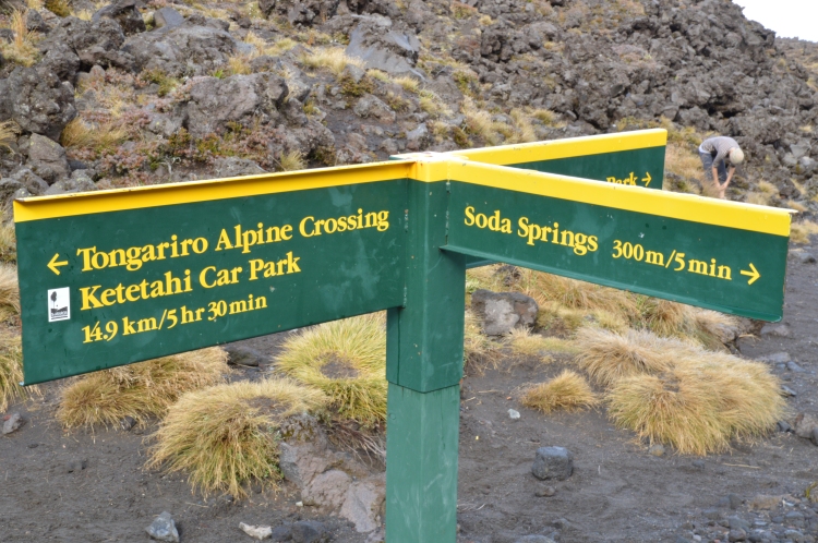 What’s makes it harder though, is people don’t or can’t move out of the way to let you pass. And what I find is that when you have the energy to go fast, but you’re stuck behind people who won’t or can’t move out of the way, it just sucks the energy out of you. The one thing about the crossing, is that a good portion of the crossing only allows 1 to 2 people on the path. Many parts there is only room for one person, which really sucks if you’re stuck behind a slow person. And when there’s enough room for two, then you get stuck behind the people who are using walking poles, as in a pole in each hand. You might as well be hogging the path to yourself. If you know there is someone huffing and puffing behind you, just stop and let us pass! Anyway, on the Devil’s staircase, I eventually lost sight of Mt. Doom but that’s alright. It was in the clear as I walked across the Mangatepopo Saddle. I will get a chance to see what it is like, climbing wise. Wrong. The clouds returned. By the time we reached the edge of the South crater, Mt. Doom was engulfed in cloud. Hmmm. Well, we still had a ways to go before hitting the track for Mt. Doom. And there were more stairs to go, so by the time I trudge up these stairs, perhaps the clouds will clear a little. That would be a ‘No’. By the time I hit the start of the path for Mt. Doom, it was thick cloud. But from what I could see, it was enough for little warning bells to start to tinkle in my head, or maybe it was my iPod. We’ll see how I feel after I complete the Crossing. I’m not going to count out Mt. Doom just yet.
Okay, next section, South Crater. There is a reprieve here where you could stop and refuel before heading onto the next set of stairs/steps that takes you to the Red Crater.
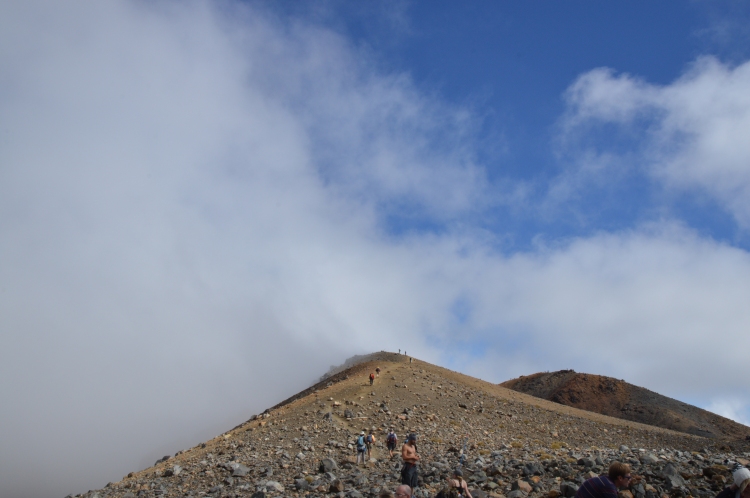
Wow! The descriptions of the names are basic but certainly fit the bill. The Red Crater is definitely red and the South Crater is in the south part of the Tongariro Alpine Crossing. I wonder if the Emerald Lakes and the Blue Lake fits the description as well. You betcha! But again I am jumping ahead of myself. Once you reach the Red Crater, there is another little plateau to rest before again, trudging upwards. As soon as you reach another peak, you could look down to see admire the handwork that you did to get up there, or you could turn around and face forward and see why you have come up.
Just before you reach the Red Crater, you could also veer off and climb Mt. Tongariro.
After I finished admiring Mt. Tongariro in the clouds and the amazing Red Crater, it was time to move onwards and upwards. Emerald Lakes was the next stop and nearby Blue Lake. It didn’t take very long to get to the Lakes from the Red Crater. Yes it was still uphill, but what slowed everyone down was the slippery slope down to the lakes. You are walking down scoria/scree. It’s like walking on several feet of loose, dry sand. There is no friction so there is a lot of slipping. Ron did warn us about this section. He said to put our heel down first. It works for a while but you still slip. I slipped three times. And it’s scary when you slip. Remember, you are not alone. There is always someone behind you or in front of you. They will not stop your fall. You will only take them down with you. And this is the same stuff that I would be climbing up and down on when I climb Mt. Doom. Hmmm. And Mt. Doom is steeper. Hmmm.
After admiring the Emerald Lakes, it was time to get a close up of Blue Lake. There was another flattish walk. Remember to turn around and admire the view. This one is the most amazing of all. You see the Red Crater from behind and then you see the crazy slide that you walked down to get to the Emerald Lakes and you also see the train of people following the same track. It’s amazing in a good and sad way. Good as in you’ve accomplished a lot, but sad because you will never have the peace and tranquility of a regular hike. But I guess this isn’t really a regular hike.
When you get to Blue Lake, please don’t eat or drink here. It’s considered sacred to the Maori. I guess that would explain why everyone was eating at Red Crater or Emerald Lakes.
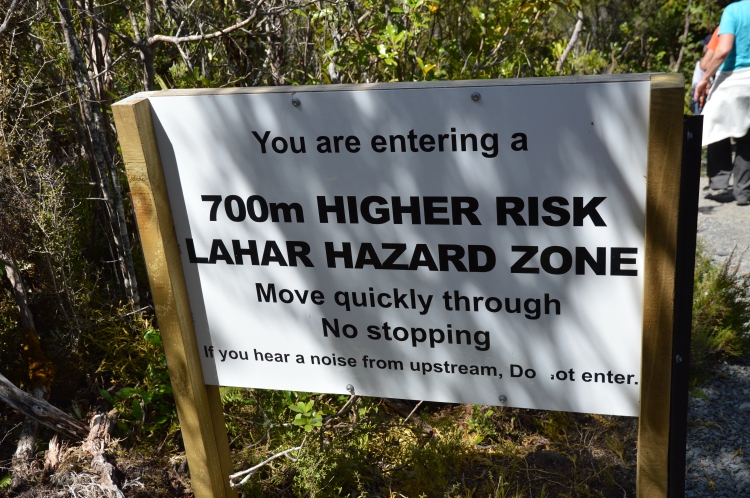
Now that we have reached Blue Lake, it was time for the downhill section, through the Volcanic Hazard area. Hurray. Good to see that there are signs up warning us about the track. I hope it works. Or we are all doomed, since the suspected origin of the recent volcanic activity is in the vicinity of this final section of the track. It’s amazing how high up we are though. You can see in the distance Lake Taupo! And then over to the right, you can see the billowing steam clouds. Hmmmm. From the suspected origin…of the recent volcanic activity. It was also disturbing to see that the tracks are still being fixed up from the previous volcanic activity. The picture of the damage done to the last hut from the volcanic activity doesn’t really mean much until you are there. And you see the craters left behind by rocks that were spewed out. And the billowing steam clouds and the one section of the track that was damaged and ultimately closed.
From Blue Lake to the final hut, there is no shade whatsoever. Make sure you bring a hat. In fact, all the essential gear that is listed on the DOC website and on all the information sheets about The Crossing, are necessary. I used every piece of clothing that it had listed. Everything except the waterproof pants and the first aid kit. Thank goodness for that. The changes in temperature vary throughout the day and throughout the section you are climbing. Remember that you are at much higher elevations so it gets colder as you go higher. And the windchill factor, take that into consideration as well. The only thing you can’t really prepare for is if there is volcanic activity.
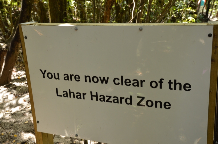
The final section of the track took us through a lovely forested area. The shade and the breeze, the beautiful green trees! It was such a dramatic change considering the Mars-like environment that we walked on for the last 5 hours. It was a very welcome change. Until we saw the signs again. And this one seemed more urgent than the previous signs.
Seven hundred metres sure took a long time to get through.
And then just around the corner was the parking lot. The forest was so dense, you couldn’t see it until you turned the corner and then you are surrounded by people who have also finished the track and are now just waiting for a ride back.
Amazing! This was the best day-walk I have ever been on! I so love the Tongariro Alpine Crossing. It only took me 6 hours and 48 minutes to complete! 19.4 km of track. Two active volcanoes. Three Emerald Lakes. One Blue Lake. Two Craters. Scree, Scoria, Boardwalks, Lava rocks. Hazard signs galore! And a dense forest with a serious Lahar concern! How can you not love this?
For those few observant readers, you may notice that there is a time difference between starting at the Mangatepopo parking lot, 6hrs 20 to complete versus the Ketetahi parking lot, 8hrs 30 to complete. The majority of the “Crossers” start at the Mangatepopo end because if you start at the Ketetahi end, you will be headed uphill for a very long time. Just to the hut it would take you 3hrs. And you still have to go up to the Blue Lake. Where as the Mangatepopo end is a little bit kinder. Hence the two hour difference. And here’s a useless bit of information for you. The New Zealand Army used to get their recruits to do the crossing starting at the Ketetahi end and they would have to have all there gear on with their full packs. Yikes! Love it!
I wish you all could’ve done the Tongariro Alpine Crossing with me! Luv Aunty!




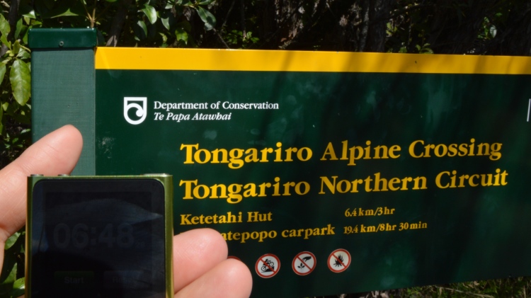
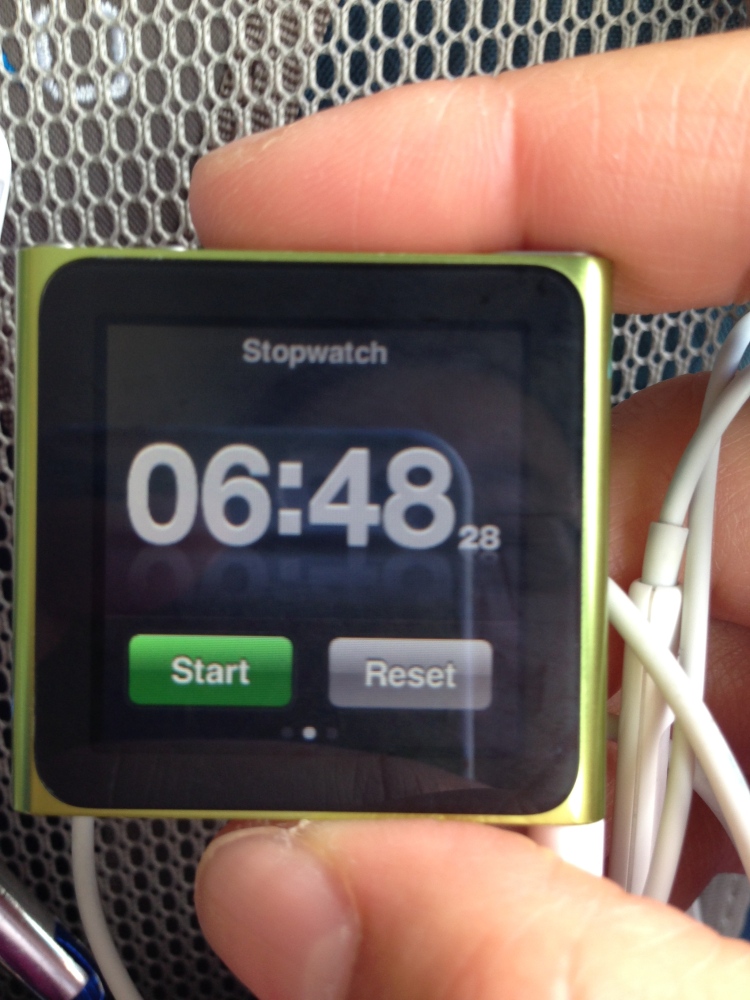
What an amazing journey!
You did it auntie!
Sent from my iPad
>
LikeLike